
Coadan:Ascending Errigal - geograph.org.uk - 1459252.jpg
Cha nel jeeskeaylley ny smoo ry-gheddyn.
Ascending_Errigal_-_geograph.org.uk_-_1459252.jpg (640 × 479 pixelyn, mooadys y choadan: 386 KB, sorçh MIME: image/jpeg)
Giare-choontey
| Coontey |
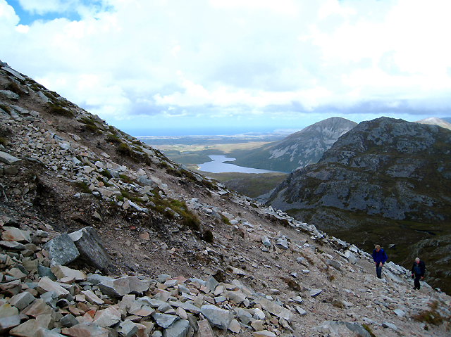
English: Ascending Errigal. The steep route to the summit of Errigal - note that the horizon here is level - and much of it is a scramble over loose quartz scree. The view in the background is towards Loch Alltáin with the coastline near Falcarragh in the background.. |
||
| Date | |||
| Bun | From geograph.org.uk | ||
| Author | Ross | ||
| Permission (Reusing this file) |
This file is licensed under the Creative Commons Attribution-Share Alike 2.0 Generic license. Attribution: Ross
|

| Camera location | | View this and other nearby images on: OpenStreetMap |
|---|
_heading:0.00&language=gv)
| Object location | | View this and other nearby images on: OpenStreetMap |
|---|
_heading:0.00&language=gv)
Shennaghys y choadan
Crig er daayt/am ennagh son fakin er y choadan myr v’eh ec y traa shen.
| Daayt/Am | Ingin-ordaag | Towshanyn | Ymmydeyr | Cohaggloo | |
|---|---|---|---|---|---|
| bio | 04:35, 2 Mayrnt 2011 | | 640 × 479 (386 KB) | GeographBot | == {{int:filedesc}} == {{Information |description={{en|1=Ascending Errigal The steep route to the summit of Errigal - note that the horizon here is level - and much of it is a scramble over loose quartz scree. The view in the background is towards Loch Al |
Ymmyd y choadan
Ta ny 1 duillag eiyrtyssagh kianglt rish y choadan shoh:
Global file usage
The following other wikis use this file:
- Usage on en.wikipedia.org
- Usage on ga.wikipedia.org
- Usage on gl.wikipedia.org
- Usage on hr.wikipedia.org
- Usage on it.wikipedia.org
- Usage on no.wikipedia.org
- Usage on pl.wikipedia.org