
Coadan:Carndonagh SW View 1996 08 29-mod.jpg

Size of this preview: 800 × 533 pixels. Other resolutions: 320 × 213 pixels | 640 × 427 pixels | 1,024 × 683 pixels | 1,280 × 853 pixels | 2,560 × 1,707 pixels | 3,072 × 2,048 pixels.
Jeeskeaylley ymlane (3,072 × 2,048 pixelyn, mooadys y choadan: 702 KB, sorçh MIME: image/jpeg)
Giare-choontey
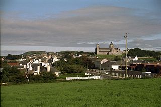
| Coontey | Carndonagh, County Donegal in Ireland, as seen from south-west. |
| Date | |
| Bun | Own work |
| Author | Photographed by Andreas F. Borchert and retouched by Jasonm who corrected the levels a little. |
| Other versions |
 |
| Camera location | | View this and other nearby images on: OpenStreetMap |
|---|
Kieddagh:

|
Permission is granted to copy, distribute and/or modify this document under the terms of the GNU Free Documentation License, Version 1.2 or any later version published by the Free Software Foundation; with no Invariant Sections, no Front-Cover Texts, and no Back-Cover Texts. A copy of the license is included in the section entitled GNU Free Documentation License. |
| This file is licensed under the Creative Commons Attribution-Share Alike 3.0 Unported license. | ||
| ||
| This licensing tag was added to this file as part of the GFDL licensing update. |
Shennaghys y choadan
Crig er daayt/am ennagh son fakin er y choadan myr v’eh ec y traa shen.
| Daayt/Am | Ingin-ordaag | Towshanyn | Ymmydeyr | Cohaggloo | |
|---|---|---|---|---|---|
| bio | 19:40, 7 Toshiaght Arree 2006 | | 3,072 × 2,048 (702 KB) | Jasonm~commonswiki | I took Carndonagh_SW_View_1996_08_29.jpg and corrected the levels a little. |
Ymmyd y choadan
Ta ny 1 duillag eiyrtyssagh kianglt rish y choadan shoh:
Global file usage
The following other wikis use this file:
- Usage on bg.wikipedia.org
- Usage on de.wikipedia.org
- Usage on en.wikipedia.org
- Usage on es.wikipedia.org
- Usage on eu.wikipedia.org
- Usage on fa.wikipedia.org
- Usage on fr.wikipedia.org
- Usage on nl.wikipedia.org
- Usage on sv.wikipedia.org