
Coadan:Faroe Islands location map.svg

Size of this PNG preview of this SVG file: 465 × 600 pixels. Other resolutions: 186 × 240 pixels | 372 × 480 pixels | 595 × 768 pixels | 793 × 1,024 pixels | 1,587 × 2,048 pixels | 775 × 1,000 pixels.
Jeeskeaylley ymlane (coadan SVG, 775 × 1,000 phixel dy ennymagh, mooadys y choadan: 63 KB)
Giare-choontey
| Coontey |
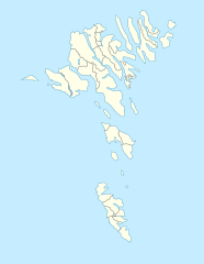
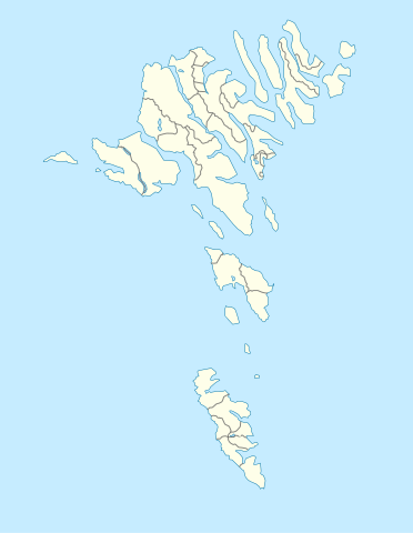
English: Location map of the Faroe Islands
Equirectangular projection, N/S stretching 213 %. Geographic limits of the map:
Deutsch: Positionskarte der Färöer
Quadratische Plattkarte, N-S-Streckung 213 %. Geographische Begrenzung der Karte:
|
| Date | |
| Bun | Own work |
| Author | Erik Frohne |
| Other versions |
Derivative works of this file: Strandfaraskip route map.svg Municipalities of the faroe islands 2005.png |
| SVG genesis |
Kieddagh:
I, the copyright holder of this work, hereby publish it under the following licenses:

|
Permission is granted to copy, distribute and/or modify this document under the terms of the GNU Free Documentation License, Version 1.2 or any later version published by the Free Software Foundation; with no Invariant Sections, no Front-Cover Texts, and no Back-Cover Texts. A copy of the license is included in the section entitled GNU Free Documentation License. |
This file is licensed under the Creative Commons Attribution-Share Alike 3.0 Unported license.
- You are free:
- to share – to copy, distribute and transmit the work
- to remix – to adapt the work
- Under the following conditions:
- attribution – You must give appropriate credit, provide a link to the license, and indicate if changes were made. You may do so in any reasonable manner, but not in any way that suggests the licensor endorses you or your use.
- share alike – If you remix, transform, or build upon the material, you must distribute your contributions under the same or compatible license as the original.
You may select the license of your choice.
Shennaghys y choadan
Crig er daayt/am ennagh son fakin er y choadan myr v’eh ec y traa shen.
| Daayt/Am | Ingin-ordaag | Towshanyn | Ymmydeyr | Cohaggloo | |
|---|---|---|---|---|---|
| bio | 13:27, 20 Mee ny Nollick 2020 | | 775 × 1,000 (63 KB) | Hanzlan | Húsar merged with Klaksvík |
| 12:58, 29 Averil 2010 |  | 775 × 1,000 (77 KB) | Erik Frohne | Removal of some borders according to http://www.us.fo/Default.aspx?ID=5497&M=News&PID=6574&NewsID=1842&CATID=29 | |
| 14:46, 7 Mayrnt 2009 |  | 775 × 1,000 (79 KB) | Erik Frohne | {{Information |Description={{en|1=Location map of the Faroe Islands Equirectangular projection, N/S stretching 213 %. Geographic limits of the map: * N: 62.44° N * S: 61.30° N * W: 7.88° W * E: 6.00° W}} {{de|1=Positionskarte der Färöer Quadra |
Ymmyd y choadan
Ta ny 39 duillagyn eiyrtyssagh kianglt rish y choadan shoh:
- Argir
- Eiði
- Fuglafjørður
- Glyvrar
- Haldarsvík
- Hoyvík
- Hvalba
- Hvalvík
- Hvannasund
- Hósvík
- Kaldbak
- Klaksvík
- Kollafjørður
- Kvívík
- Leirvík
- Miðvágur
- Norðdepil
- Norðragøta
- Norðskáli
- Nólsoy (balley)
- Porkeri
- Runavík
- Saltangará
- Sandavágur
- Sandur, Ellanyn ny Geyrragh
- Skopun
- Strendur
- Sumba, Ellanyn ny Geyrragh
- Syðrugøta
- Søldarfjørður
- Sørvágur
- Toftir
- Trongisvágur
- Tvøroyri
- Tórshavn
- Vestmanna
- Viðareiði
- Vágur
- Æðuvík
Global file usage
The following other wikis use this file:
- Usage on af.wikipedia.org
- Usage on an.wikipedia.org
- Usage on ar.wikipedia.org
- Usage on ast.wikipedia.org
- Usage on az.wikipedia.org
- Usage on ba.wikipedia.org
- Usage on be-tarask.wikipedia.org
- Usage on be.wikipedia.org
View more global usage of this file.