
Coadan:Hill of Ward - geograph.org.uk - 1923643.jpg

Size of this preview: 800 × 600 pixels. Other resolutions: 320 × 240 pixels | 640 × 480 pixels | 1,024 × 768 pixels | 1,280 × 960 pixels | 1,600 × 1,200 pixels.
Jeeskeaylley ymlane (1,600 × 1,200 phixel, mooadys y choadan: 641 KB, sorçh MIME: image/jpeg)
Giare-choontey
| Coontey |
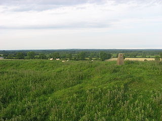
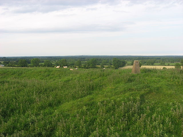
English: Hill of Ward, Athboy, Co. Meath |
| Date | |
| Bun | From geograph.org.uk |
| Author | Kieran Campbell |
| Permission (Reusing this file) |
Creative Commons Attribution Share-alike license 2.0 |
| Attribution (required by the license) | Kieran Campbell / Hill of Ward, Athboy, Co. Meath / |
| Camera location | | View this and other nearby images on: OpenStreetMap |
|---|
Kieddagh:

|
This image was taken from the Geograph project collection. See this photograph's page on the Geograph website for the photographer's contact details. The copyright on this image is owned by Kieran Campbell and is licensed for reuse under the Creative Commons Attribution-ShareAlike 2.0 license.
|
This file is licensed under the Creative Commons Attribution-Share Alike 2.0 Generic license.
Attribution: Kieran Campbell
- You are free:
- to share – to copy, distribute and transmit the work
- to remix – to adapt the work
- Under the following conditions:
- attribution – You must give appropriate credit, provide a link to the license, and indicate if changes were made. You may do so in any reasonable manner, but not in any way that suggests the licensor endorses you or your use.
- share alike – If you remix, transform, or build upon the material, you must distribute your contributions under the same or compatible license as the original.
Shennaghys y choadan
Crig er daayt/am ennagh son fakin er y choadan myr v’eh ec y traa shen.
| Daayt/Am | Ingin-ordaag | Towshanyn | Ymmydeyr | Cohaggloo | |
|---|---|---|---|---|---|
| bio | 09:56, 11 Toshiaght Arree 2011 | | 1,600 × 1,200 (641 KB) | MacTire02 | {{Information |Description ={{en|1={{en|1=Hill of Ward, Athboy, Co. Meath}}}} |Source =From [http://www.geograph.org.uk/photo/1923643 geograph.org.uk] |Author =[http://www.geograph.org.uk/profile/16934 Kieran Campbell] |Date = |
Ymmyd y choadan
Ta ny 1 duillag eiyrtyssagh kianglt rish y choadan shoh:
Global file usage
The following other wikis use this file:
- Usage on ceb.wikipedia.org
- Usage on de.wikipedia.org
- Usage on en.wikipedia.org
- Usage on lld.wikipedia.org
- Usage on sv.wikipedia.org
- Usage on www.wikidata.org