
Coadan:Ireland location map.svg

Size of this PNG preview of this SVG file: 481 × 599 pixels. Other resolutions: 192 × 240 pixels | 385 × 480 pixels | 616 × 768 pixels | 822 × 1,024 pixels | 1,643 × 2,048 pixels | 1,450 × 1,807 pixels.
Jeeskeaylley ymlane (coadan SVG, 1,450 × 1,807 pixelyn dy ennymagh, mooadys y choadan: 938 KB)
Giare-choontey
| Coontey |
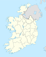
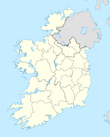
Deutsch: Positionskarte von Irland
Quadratische Plattkarte, N-S-Streckung 170 %. Geographische Begrenzung der Karte:
English: Location map of Ireland
Equirectangular projection, N/S stretching 170 %. Geographic limits of the map:
|
| Date | 01-07-2008 |
| Bun | own work, using United States National Imagery and Mapping Agency data |
| Author | NordNordWest |
| Other versions |
DerivativeVersions |


|
This map has been made or improved in the German Kartenwerkstatt (Map Lab). You can propose maps to improve as well.
|
Kieddagh:
I, the copyright holder of this work, hereby publish it under the following licenses:

|
Permission is granted to copy, distribute and/or modify this document under the terms of the GNU Free Documentation License, Version 1.2 or any later version published by the Free Software Foundation; with no Invariant Sections, no Front-Cover Texts, and no Back-Cover Texts. A copy of the license is included in the section entitled GNU Free Documentation License. |
This file is licensed under the Creative Commons Attribution-Share Alike 3.0 Unported license.
- You are free:
- to share – to copy, distribute and transmit the work
- to remix – to adapt the work
- Under the following conditions:
- attribution – You must give appropriate credit, provide a link to the license, and indicate if changes were made. You may do so in any reasonable manner, but not in any way that suggests the licensor endorses you or your use.
- share alike – If you remix, transform, or build upon the material, you must distribute your contributions under the same or compatible license as the original.
You may select the license of your choice.
Shennaghys y choadan
Crig er daayt/am ennagh son fakin er y choadan myr v’eh ec y traa shen.
| Daayt/Am | Ingin-ordaag | Towshanyn | Ymmydeyr | Cohaggloo | |
|---|---|---|---|---|---|
| bio | 06:45, 18 Jerrey Souree 2020 | | 1,450 × 1,807 (938 KB) | Chipmunkdavis | Adding toggle to display pre-2014 boundaries, adjusting some code for names and shape |
| 06:47, 11 Jerrey Souree 2020 |  | 1,450 × 1,807 (908 KB) | Chipmunkdavis | Overhauling code, together with code from File:Galway City in Ireland.svg (itself derived from this file), to be both simpler and more easily editable. All islands are now grouped with their mainland county, and counties are grouped into provinces. Groups exist for traditional counties where divided. | |
| 12:08, 12 Mean Fouyir 2014 |  | 1,450 × 1,807 (597 KB) | Ravenpuff | Retry that | |
| 11:57, 12 Mean Fouyir 2014 |  | 1,450 × 1,807 (597 KB) | Ravenpuff | Merged North Tipperary and South Tiperrary, Limerick and County Limerick, Waterford and County Waterford (Local Government Reform Act 2014) | |
| 18:04, 1 Mean Fouyir 2009 |  | 1,450 × 1,807 (598 KB) | NordNordWest | ||
| 19:08, 25 Luanistyn 2008 |  | 1,450 × 1,807 (599 KB) | NordNordWest | size correction | |
| 18:13, 19 Jerrey Souree 2008 |  | 483 × 602 (581 KB) | NordNordWest | ||
| 14:13, 1 Jerrey Souree 2008 |  | 483 × 602 (554 KB) | NordNordWest | {{Information |Description= {{de|Positionskarte von Irland}} Quadratische Plattkarte, N-S-Streckung 170 %. Geographische Begrenzung der Karte: * N: 55.6° N * S: 51.2° N * W: 11.0° W * O: 5.0° W {{en|Location map of [[:en:Ireland|Ireland |
Ymmyd y choadan
Ta yn 82 duillag eiyrtyssagh kianglt rish y choadan shoh:
- Achair
- An Aitinn Bhuí
- An Baile Nua, Coontae Ghoon ny Ghoal
- An Caisleán Nua, Coontae Ghoon ny Ghoal
- An Charraig, Coontae Ghoon ny Ghoal
- An Clochán Liath
- An Fál Carrach
- An Inse, Coontae yn Vee
- An Leadhb Gharbh
- An Mullach Mór, Coontae Shliggee
- An Scrín, Coontae yn Vee
- Ard Cath
- Ard an Rátha
- Baile Bháigh
- Baile Ghib
- Baile Iúiliáin
- Baile Mhic Gormáin
- Baile Nua na Manach
- Baile Roibín, Coontae yn Vee
- Baile Shláine
- Baile Uí Mhornáin
- Baile an Bheileogaigh
- Baile an Bhiataigh
- Baile an Bhóthair, Coontae yn Vee
- Baile an Cheantaigh
- Baile an Mhóta, Coontae Shliggee
- Baile na nGallóglach
- Baile Átha Buí
- Baile Átha Troim
- Baile Íomhair
- Bealach Féich
- Beigthigh
- Binn Éadair
- Buaile na Bréachmhaí
- Bun Cranncha
- Bun Dobhráin
- Bun an Phobail
- Béal Átha Seanaidh
- Carn Domhnach
- Carn na Ros
- Ceanannas, Coontae yn Vee
- Cill Charthaigh
- Cill Dealga
- Cill Mheasáin
- Cill Táile
- Cliafuine
- Cluain Aodha
- Cluain Ioraird
- Cnoc an Línsigh
- Coill Chluana
- Coill an Chollaigh
- Conmhaigh
- Corkee
- Cúil Mhuine
- Divlyn
- Domhnach Phádraig
- Doon ny Ghoal
- Dún Cionnaola
- Galliu
- Gaoth Dobhair
- Gleann Cholm Cille
- Inbhear
- Keeill Chennee
- Leffyr
- Limmeragh
- Littyr Kennain
- Magh
- Mannishter Beigthigh
- Na Cealla Beaga
- Na Frosa
- Na Gleannta
- Purt Largey
- Ráth Bhoth
- Ráth Chairn
- Ráth Mealtáin
- Shliggagh
- Srath an Urláir
- Tamhnach an tSalainn
- Teileann
- Tobar an Choire
- Yn Ooive
- Ymmydeyr:Shimmin Beg/kishtey geinnee
Global file usage
The following other wikis use this file:
- Usage on af.wikipedia.org
- Usage on am.wikipedia.org
- Usage on ar.wikipedia.org
- Usage on arz.wikipedia.org
- Usage on ba.wikipedia.org
- Usage on be-tarask.wikipedia.org
- Usage on be.wikipedia.org
- Usage on bg.wikipedia.org
View more global usage of this file.