
Coadan:Isle of Man location map.svg

Size of this PNG preview of this SVG file: 654 × 600 pixels. Other resolutions: 262 × 240 pixels | 524 × 480 pixels | 838 × 768 pixels | 1,117 × 1,024 pixels | 2,234 × 2,048 pixels | 1,200 × 1,100 pixels.
Jeeskeaylley ymlane (coadan SVG, 1,200 × 1,100 phixel dy ennymagh, mooadys y choadan: 93 KB)
| Coontey |
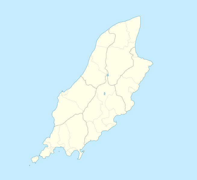
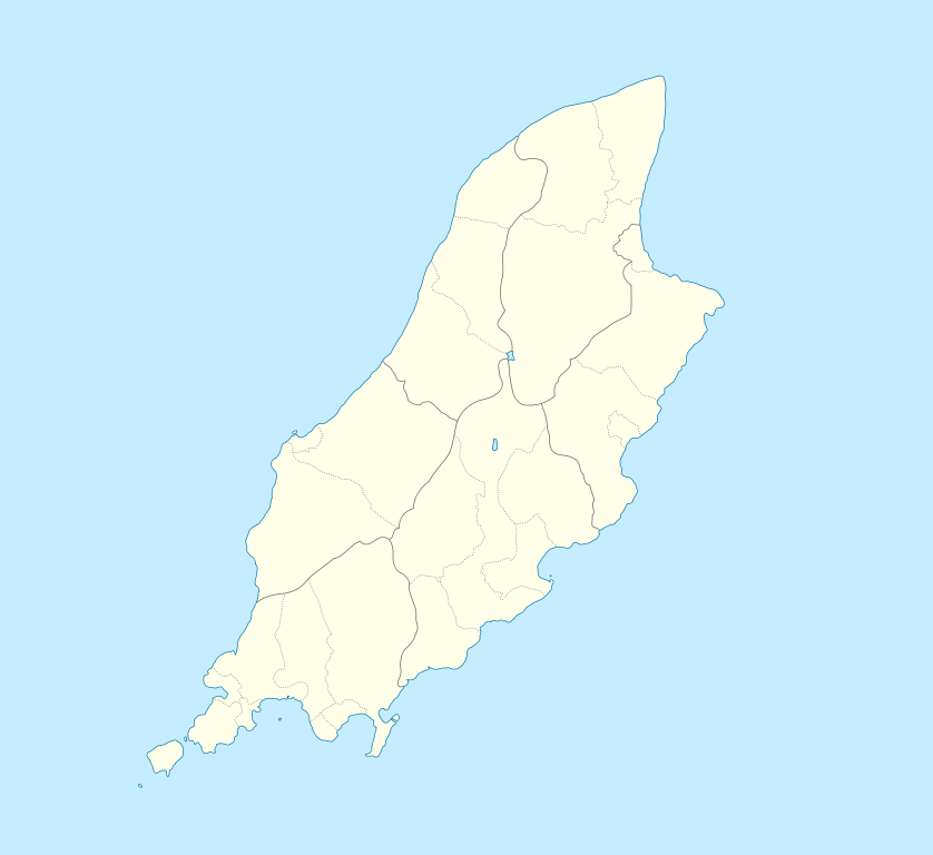
English: Location map of the Isle of Man, showing sheadings as well as local authorities (towns, villages, districts, parishes).
Geographic limits of the map:
|
| Date | |
| Bun | |
| Author |
|
I, the copyright holder of this work, hereby publish it under the following licenses:
This file is licensed under the Creative Commons Attribution-Share Alike 2.5 Generic, 2.0 Generic and 1.0 Generic license.
- You are free:
- to share – to copy, distribute and transmit the work
- to remix – to adapt the work
- Under the following conditions:
- attribution – You must give appropriate credit, provide a link to the license, and indicate if changes were made. You may do so in any reasonable manner, but not in any way that suggests the licensor endorses you or your use.
- share alike – If you remix, transform, or build upon the material, you must distribute your contributions under the same or compatible license as the original.
| This file is licensed under the Creative Commons Attribution-Share Alike 3.0 Unported license. | ||
| ||
| This licensing tag was added to this file as part of the GFDL licensing update. |

|
Permission is granted to copy, distribute and/or modify this document under the terms of the GNU Free Documentation License, Version 1.2 or any later version published by the Free Software Foundation; with no Invariant Sections, no Front-Cover Texts, and no Back-Cover Texts. A copy of the license is included in the section entitled GNU Free Documentation License. |
You may select the license of your choice.
Original upload log
This image is a derivative work of the following images:
- File:IsleOfMan_SheadingsAndParishes-en.svg licensed with Cc-by-sa-2.5,2.0,1.0, Cc-by-sa-3.0-migrated, GFDL
- 2008-01-17T12:48:28Z Sémhur 1200x1100 (227618 Bytes) Update
- 2007-05-29T20:36:04Z Sémhur 1200x1100 (364350 Bytes) {{Information |Description=Map in english of the [[:en:Isle of Man|Isle of Man]], with bounds of sheadings, towns, villages, districts and parishes. |Source=Own work. Based on maps [[:Image:Isle of Man map-fr.svg]], [[:Image:
Uploaded with derivativeFX
Shennaghys y choadan
Crig er daayt/am ennagh son fakin er y choadan myr v’eh ec y traa shen.
| Daayt/Am | Ingin-ordaag | Towshanyn | Ymmydeyr | Cohaggloo | |
|---|---|---|---|---|---|
| bio | 23:00, 24 Mean Fouyir 2009 | | 1,200 × 1,100 (93 KB) | Entlinkt | {{Information |Description={{en|1=Location map of the Isle of Man, showing sheadings as well as local authorities (towns, villages, districts, parishes). Geographic limits of the map: * W: -4° 58' 0" * E: -4° 7' 0" * S: 54° 0' 0" * N: 54° 27' 30"}} |
Ymmyd y choadan
Ta ny 36 duillagyn eiyrtyssagh kianglt rish y choadan shoh:
- Andreas, Mannin
- Balley Beg, Cairbre
- Balley Beg, Lonan
- Balley Chashtal
- Balley Drine
- Balley Keeill Eoin
- Balley Keeill Vaayl
- Balley Keeilley
- Balley Kew Aeg
- Balley Noa
- Balley Sallagh
- Balley ny Croshey
- Balley ny Loghey
- Bayr Garroo
- Camys y Ree
- Colby
- Creneash
- Cronk y Voddee
- Delbee
- Doolish
- Forsdal
- Glion Muigh
- Glion Vian
- Kione Droghad
- Laksaa
- Mwyllin Doo Aah
- Purt Soderick
- Purt le Moirrey
- Purt ny h-Inshey
- Purt Çhiarn
- Rhumsaa
- Ronnag
- Sulby
- Yn Arbyl
- Yn Braaid
- Yn Strang
Global file usage
The following other wikis use this file:
- Usage on af.wikipedia.org
- Usage on ar.wikipedia.org
- Usage on ast.wikipedia.org
- Usage on azb.wikipedia.org
- Usage on ba.wikipedia.org
- Usage on be.wikipedia.org
- Usage on bg.wikipedia.org
- Usage on bn.wikipedia.org
- Usage on br.wikipedia.org
- Usage on ceb.wikipedia.org
- Plantilya:Location map Isle of Man
- German
- Patrick
- Bride
- Andreas
- Douglas
- Saint Michaels Island
- Port Douglas
- Peel
- Isle of Man (pagklaro)
- Douglas Bay
- Isle of Man
- Santon
- Clay Head
- Craig Rock
- Ramsey Bay
- Rue Point
- Ramsey
- River Glass
- Chicken Rock
- Castletown
- Calf Sound
- Point of Ayre
- Crosby
- Little Ness
- Laksaa
- Snaefell
View more global usage of this file.