
Coadan:Map of Scotland within the United Kingdom.svg

Size of this PNG preview of this SVG file: 387 × 600 pixels. Other resolutions: 155 × 240 pixels | 309 × 480 pixels | 495 × 768 pixels | 660 × 1,024 pixels | 1,321 × 2,048 pixels | 616 × 955 pixels.
Jeeskeaylley ymlane (coadan SVG, 616 × 955 pixelyn dy ennymagh, mooadys y choadan: 125 KB)
Giare-choontey
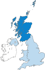
| Coontey | Map of Scotland (dark blue) within the United Kingdom. |
| Date | (UTC) |
| Bun |
This file was derived from: United Kingdom in the British Isles.svg: |
| Author | Peeperman |
| Other versions |
|
| SVG genesis | This locator map was created with Adobe Illustrator. |
Kieddagh:
I, the copyright holder of this work, hereby publish it under the following licenses:
| This file is licensed under the Creative Commons Attribution-Share Alike 3.0 Unported license. | ||
| ||
| This licensing tag was added to this file as part of the GFDL licensing update. |

|
Permission is granted to copy, distribute and/or modify this document under the terms of the GNU Free Documentation License, Version 1.2 or any later version published by the Free Software Foundation; with no Invariant Sections, no Front-Cover Texts, and no Back-Cover Texts. A copy of the license is included in the section entitled GNU Free Documentation License. |
You may select the license of your choice.
Shennaghys y choadan
Crig er daayt/am ennagh son fakin er y choadan myr v’eh ec y traa shen.
| Daayt/Am | Ingin-ordaag | Towshanyn | Ymmydeyr | Cohaggloo | |
|---|---|---|---|---|---|
| bio | 18:27, 27 Luanistyn 2012 | | 616 × 955 (125 KB) | Peeperman | minor edit |
| 18:17, 27 Luanistyn 2012 |  | 616 × 955 (125 KB) | Peeperman | {{Information |Description=Map of Scotland (dark blue) within the United Kingdom. |Source={{Derived from|British Isles United Kingdom.svg|display=50}} |Date=2012-06-14 19:17 (UTC) |Author=Peeperman |Permission= |other_versions=[[File... |
Ymmyd y choadan
Ta ny 1 duillag eiyrtyssagh kianglt rish y choadan shoh:
Global file usage
The following other wikis use this file:
- Usage on an.wikipedia.org
- Usage on ar.wikipedia.org
- Usage on ast.wikipedia.org
- Usage on de.wikipedia.org
- Usage on de.wiktionary.org
- Usage on el.wiktionary.org
- Usage on en.wikipedia.org
- Usage on es.wikipedia.org
- Usage on fr.wikipedia.org
- Usage on gd.wikipedia.org
- Usage on gl.wikipedia.org
- Usage on ht.wikipedia.org
- Usage on id.wikipedia.org
- Usage on incubator.wikimedia.org
- Usage on it.wikipedia.org
- Usage on it.wikinews.org
- Usage on it.wiktionary.org
- Usage on pt.wikipedia.org
- Usage on sr.wikipedia.org
- Usage on sv.wikipedia.org
- Usage on uk.wikipedia.org
- Usage on zh.wikipedia.org