
Coadan:Southwest Isle of Man - Niarbyl - kingsley - 23-JUN-09.jpg

Size of this preview: 800 × 600 pixels. Other resolutions: 320 × 240 pixels | 640 × 480 pixels | 1,024 × 768 pixels | 1,280 × 960 pixels | 2,560 × 1,920 pixels.
Jeeskeaylley ymlane (2,560 × 1,920 phixel, mooadys y choadan: 1.51 MB, sorçh MIME: image/jpeg)
Giare-choontey
| Coontey |
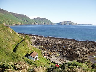
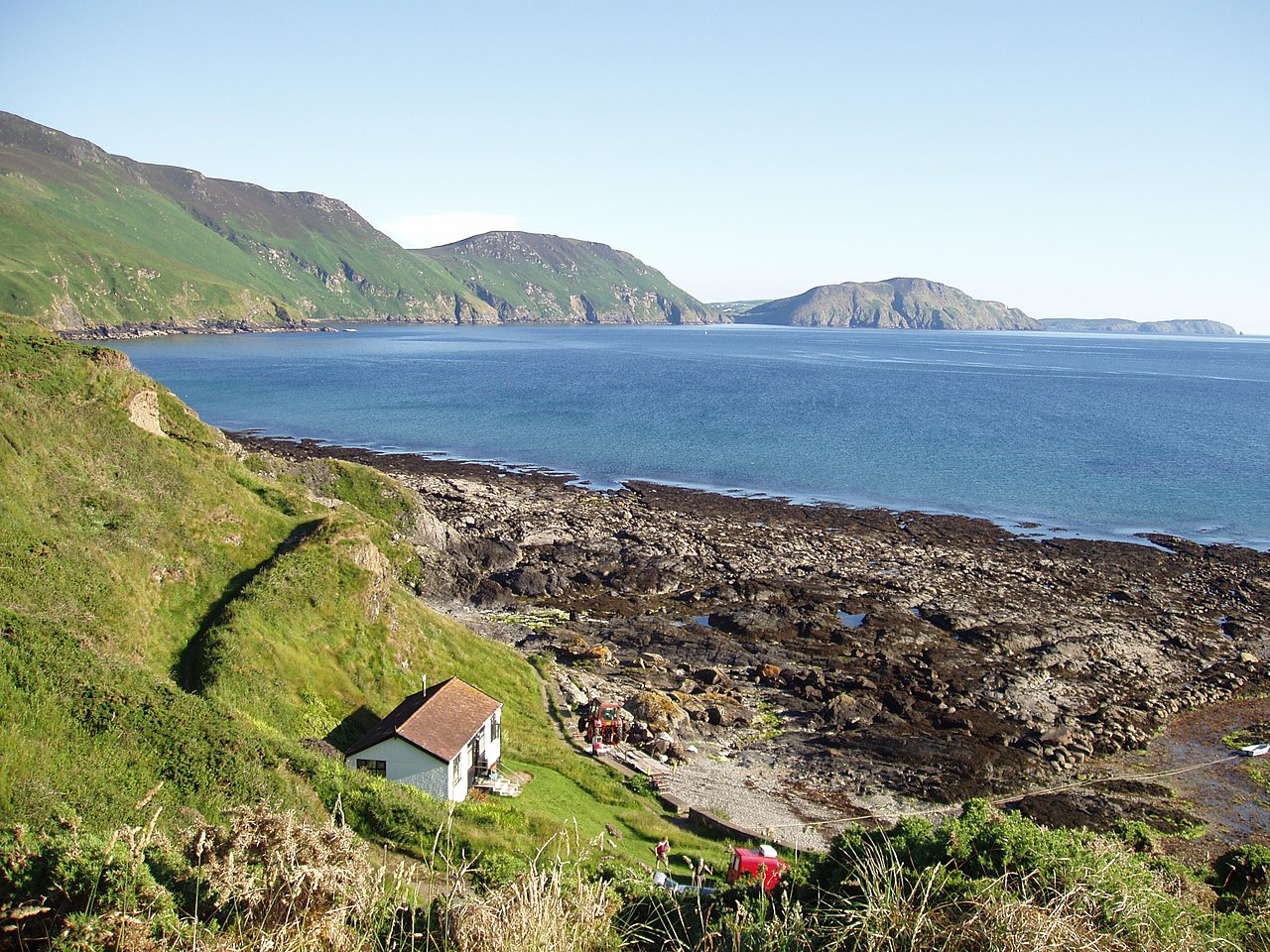
English: View across Niarbyl Bay at the southwest coastline of Isle of Man. Milner's Tower can be seen on Bradda Head. On the far right of the picture is the Calf of Man - an island off the southwest tip. |
| Date | |
| Bun | Own work |
| Author | Gregory J Kingsley |
54°9′49.7″N 4°44′24.3″W / 54.163806°N 4.740083°W
| Camera location | | View this and other nearby images on: OpenStreetMap |
|---|
Kieddagh:
I, the copyright holder of this work, hereby publish it under the following licenses:
This file is licensed under the Creative Commons Attribution-Share Alike 3.0 Unported license.
- You are free:
- to share – to copy, distribute and transmit the work
- to remix – to adapt the work
- Under the following conditions:
- attribution – You must give appropriate credit, provide a link to the license, and indicate if changes were made. You may do so in any reasonable manner, but not in any way that suggests the licensor endorses you or your use.
- share alike – If you remix, transform, or build upon the material, you must distribute your contributions under the same or compatible license as the original.

|
Permission is granted to copy, distribute and/or modify this document under the terms of the GNU Free Documentation License, Version 1.2 or any later version published by the Free Software Foundation; with no Invariant Sections, no Front-Cover Texts, and no Back-Cover Texts. A copy of the license is included in the section entitled GNU Free Documentation License. |
You may select the license of your choice.
Shennaghys y choadan
Crig er daayt/am ennagh son fakin er y choadan myr v’eh ec y traa shen.
| Daayt/Am | Ingin-ordaag | Towshanyn | Ymmydeyr | Cohaggloo | |
|---|---|---|---|---|---|
| bio | 00:43, 16 Luanistyn 2009 | | 2,560 × 1,920 (1.51 MB) | Gregory J Kingsley | {{Information |Description={{en|1=Niarbyl Bay and the southwest coastline of Isle of Man including Bradda Head (on right) as viewed from Niarbyl.}} |Source=Own work by uploader |Author=Gregory J Kingsley |Date=2009-06-23 |Permi |
Ymmyd y choadan
Ta ny 1 duillag eiyrtyssagh kianglt rish y choadan shoh:
Global file usage
The following other wikis use this file:
- Usage on en.wikipedia.org
- Usage on es.wikipedia.org
- Usage on eu.wikipedia.org
- Usage on gl.wikipedia.org
- Usage on it.wikivoyage.org