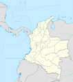
Coadan:Colombia location map.svg

Size of this PNG preview of this SVG file: 512 × 579 pixels. Other resolutions: 212 × 240 pixels | 424 × 480 pixels | 679 × 768 pixels | 905 × 1,024 pixels | 1,811 × 2,048 pixels.
Jeeskeaylley ymlane (coadan SVG, 512 × 579 pixelyn dy ennymagh, mooadys y choadan: 1.07 MB)
Shennaghys y choadan
Crig er daayt/am ennagh son fakin er y choadan myr v’eh ec y traa shen.
| Daayt/Am | Ingin-ordaag | Towshanyn | Ymmydeyr | Cohaggloo | |
|---|---|---|---|---|---|
| bio | 20:17, 22 Toshiaght Arree 2022 |  | 512 × 579 (1.07 MB) | Milenioscuro | standard colors |
| 11:10, 1 Mee ny Nollick 2017 |  | 2,027 × 2,294 (1.37 MB) | Milenioscuro | limits | |
| 11:00, 1 Mee ny Nollick 2017 |  | 2,027 × 2,294 (1.37 MB) | Milenioscuro | more visible limits | |
| 05:48, 28 Jerrey Geuree 2014 |  | 2,027 × 2,294 (1.39 MB) | Milenioscuro | correction of departamental, international and maritime boundaries, courses of rivers, coastline, and line thickness | |
| 17:01, 29 Boaldyn 2012 |  | 2,007 × 2,298 (1.07 MB) | Milenioscuro | correction of some departamental borders | |
| 18:58, 26 Mayrnt 2012 |  | 2,007 × 2,298 (1.08 MB) | Milenioscuro | correction of international borders, added layers, rivers, etc | |
| 08:12, 17 Mee Houney 2011 |  | 2,007 × 2,298 (1.04 MB) | Milenioscuro | simplification of rivers, correction of some borders | |
| 23:48, 2 Mee Houney 2009 |  | 2,007 × 2,298 (1.14 MB) | Milenioscuro | thick boundaries of departments | |
| 09:10, 1 Mee Houney 2009 |  | 2,007 × 2,298 (1.15 MB) | Milenioscuro | Adjusted to match style of location maps 2008 | |
| 07:30, 26 Jerrey Fouyir 2009 |  | 2,268 × 2,676 (1.4 MB) | Milenioscuro | maritime boundaries |
Ymmyd y choadan
Ta ny 1 duillag eiyrtyssagh kianglt rish y choadan shoh:
Global file usage
The following other wikis use this file:
- Usage on af.wikipedia.org
- Usage on als.wikipedia.org
- Usage on an.wikipedia.org
- Usage on ar.wikipedia.org
- Usage on ast.wikipedia.org
- Bogotá
- Cali
- Estadiu Doce de Octubre
- Puerto Colombia (Guainía)
- González (Cesar)
- Estadiu Deportivo Cali
- Módulu:Mapa de llocalización/datos/Colombia
- Ríu Magdalena
- Capitoliu Nacional de Colombia
- Comisión Colombiana del Espaciu
- Nevado del Ruiz
- Módulu:Mapa de llocalización/datos/Colombia/usu
- Barranquilla
- Cartagena de Indias
- Estadiu Metropolitanu Roberto Meléndez
- Palenque de San Basilio
- Copa América 2001
- Sierra de Chiribiquete
- Inírida
- Aeropuertu Internacional El Dorado
- Casa d'Adoración Norte del Cauca
- Aeropuertu Guaymaral
- Aeropuertu Internacional Alfonso Bonilla Aragón
- Aeropuertu Internacional Alfredo Vásquez Cobo
- Aeropuertu Internacional Camilo Daza
- Aeropuertu Internacional El Edén
- Aeropuertu Internacional Ernesto Cortissoz
- Aeropuertu Internacional Gustavo Rojas Pinilla
- Aeropuertu Internacional José María Córdova
- Aeropuertu Internacional Matecaña
View more global usage of this file.


