
Coadan:Cornwall map small.png
Cha nel jeeskeaylley ny smoo ry-gheddyn.
Cornwall_map_small.png (331 × 315 pixelyn, mooadys y choadan: 27 KB, sorçh MIME: image/png)
Giare-choontey
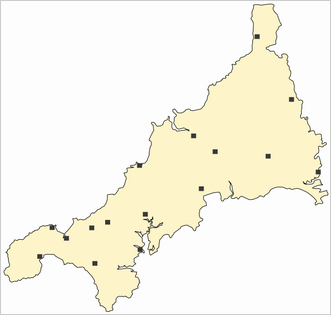
| Coontey | Map of Cornwall, Unted Kingdom, with major settlements located | ||
| Date | |||
| Bun | Own work | ||
| Author | Joowwww | ||
| Permission (Reusing this file) |
|
Shennaghys y choadan
Crig er daayt/am ennagh son fakin er y choadan myr v’eh ec y traa shen.
| Daayt/Am | Ingin-ordaag | Towshanyn | Ymmydeyr | Cohaggloo | |
|---|---|---|---|---|---|
| bio | 10:48, 1 Averil 2009 | | 331 × 315 (27 KB) | Joowwww | new map |
| 23:00, 31 Mayrnt 2009 |  | 300 × 280 (26 KB) | Jolly Janner | Reverted as Cornwall is now a unitary authority. | |
| 10:56, 21 Boaldyn 2008 |  | 320 × 313 (30 KB) | Joowwww | added towns and key | |
| 21:52, 20 Boaldyn 2008 |  | 320 × 313 (30 KB) | Joowwww | new build, added border | |
| 12:23, 5 Mee ny Nollick 2007 |  | 285 × 273 (29 KB) | Joowwww | == Summary == {{Information |Description=Outline map of Cornwall, Unted Kingdom. |Source=self-made |Date=1 December 2007 |Author= Joowwww |Permission=pd |other_versions= }} == Licensing == {{PD-self}} Category:Maps of Cornwall | |
| 15:03, 1 Mee ny Nollick 2007 |  | 300 × 280 (26 KB) | Joowwww | == Summary == {{Information |Description=Outline map of Cornwall, Unted Kingdom. |Source=self-made |Date=1 December 2007 |Author= Joowwww |Permission=pd |other_versions= }} == Licensing == {{PD-self}} | |
| 14:40, 1 Mee ny Nollick 2007 |  | 400 × 374 (28 KB) | Joowwww | {{Information |Description=Outline map of Cornwall, Unted Kingdom. |Source=self-made |Date=1 December 2007 |Author= Joowwww |Permission=pd |other_versions= }} |
Ymmyd y choadan
Ta yn 2 duillag eiyrtyssagh kianglt rish y choadan shoh:
Global file usage
The following other wikis use this file:
- Usage on cy.wikipedia.org
- Usage on de.wikipedia.org
- Usage on de.wiktionary.org
- Usage on en.wikipedia.org
- Usage on eu.wikipedia.org
- Usage on id.wikipedia.org
- Usage on kw.wikipedia.org
- Usage on mwl.wikipedia.org
- Usage on nl.wikipedia.org
- Usage on os.wikipedia.org
- Usage on pt.wikipedia.org
- Usage on vi.wikipedia.org