
Coadan:Estonia location map (2005-2017) no rivers.svg

Size of this PNG preview of this SVG file: 718 × 600 pixels. Other resolutions: 287 × 240 pixels | 575 × 480 pixels | 920 × 768 pixels | 1,226 × 1,024 pixels | 2,452 × 2,048 pixels | 1,668 × 1,393 pixels.
Jeeskeaylley ymlane (coadan SVG, 1,668 × 1,393 pixelyn dy ennymagh, mooadys y choadan: 407 KB)
Giare-choontey
| Coontey |
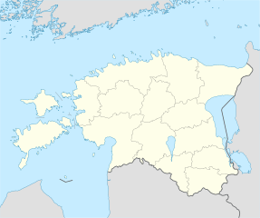
Deutsch: Positionskarte von Estland
Quadratische Plattkarte, N-S-Streckung 180 %. Geographische Begrenzung der Karte:
English: Location map of Estonia
Equirectangular projection, N/S stretching 180 %. Geographic limits of the map:
|
||
| Date | |||
| Bun | own work, using United States National Imagery and Mapping Agency data | ||
| Author | NordNordWest | ||
| Other versions |
Derivative works of this file: |
||
| SVG genesis |
|

_no_rivers.svg)
.svg)
Kieddagh:
I, the copyright holder of this work, hereby publish it under the following licenses:

|
Permission is granted to copy, distribute and/or modify this document under the terms of the GNU Free Documentation License, Version 1.2 or any later version published by the Free Software Foundation; with no Invariant Sections, no Front-Cover Texts, and no Back-Cover Texts. A copy of the license is included in the section entitled GNU Free Documentation License. |
This file is licensed under the Creative Commons Attribution-Share Alike 3.0 Unported license.
- You are free:
- to share – to copy, distribute and transmit the work
- to remix – to adapt the work
- Under the following conditions:
- attribution – You must give appropriate credit, provide a link to the license, and indicate if changes were made. You may do so in any reasonable manner, but not in any way that suggests the licensor endorses you or your use.
- share alike – If you remix, transform, or build upon the material, you must distribute your contributions under the same or compatible license as the original.
You may select the license of your choice.
Shennaghys y choadan
Crig er daayt/am ennagh son fakin er y choadan myr v’eh ec y traa shen.
| Daayt/Am | Ingin-ordaag | Towshanyn | Ymmydeyr | Cohaggloo | |
|---|---|---|---|---|---|
| bio | 06:14, 6 Boaldyn 2019 | | 1,668 × 1,393 (407 KB) | Lasunncty | fix svg errors and reduce file size |
| 20:05, 9 Boaldyn 2009 |  | 1,668 × 1,393 (464 KB) | NordNordWest | some troubles with changing location maps that way | |
| 17:18, 9 Boaldyn 2009 |  | 1,000 × 835 (639 KB) | Ahnode | *1. Resized the objects to W:1000px, H:835px. *2. Created two separate layers for Estonia itself and the rest of the world. *3. Subtracted lakes from shape areas and divided area of Estonia into counties to ease future creation of location maps. | |
| 19:03, 25 Luanistyn 2008 |  | 1,668 × 1,393 (464 KB) | NordNordWest | size correction | |
| 14:11, 7 Jerrey Souree 2008 |  | 556 × 464 (467 KB) | NordNordWest | ||
| 14:25, 29 Mean Souree 2008 |  | 556 × 464 (468 KB) | NordNordWest | {{Information |Description= {{de|Positionskarte von Estland}} Quadratische Plattkarte, N-S-Streckung 180 %. Geographische Begrenzung der Karte: * N: 60.4° N * S: 57.2° N * W: 21.5° O * O: 28.4° O {{en|Location map of [[:en:Estonia|Esto |
Ymmyd y choadan
Ta ny 1 duillag eiyrtyssagh kianglt rish y choadan shoh:
Global file usage
The following other wikis use this file:
- Usage on af.wikipedia.org
- Usage on ba.wikipedia.org
- Usage on be-tarask.wikipedia.org
- Талін
- Шаблён:Лякалізацыйная мапа Эстоніі
- Саарэмаа
- Талінскі ўнівэрсытэт
- Валга
- Выру
- Йыхві
- Вільяндзі
- Харку (возера)
- Выртс’ярв
- Пярну
- Муху
- Йыгева
- Раквэрэ
- Тартускі ўнівэрсытэт
- Тарту
- Шаблён:Пратока
- Шаблён:Пратока/Дакумэнтацыя
- Музэй акупацыяў
- Царква Сьвятога Міхаіла (Кейля)
- Царква прытулку Сьвятога Яна (Талін)
- Палдыскі
- Царква Сьвятога Яна (Талін)
- Калёна Перамогі ў вайне за незалежнасьць Эстоніі
- Нарва (горад)
- Кейля
- Курэсаарэ
- Саўэ
- Царква Сьвятога Олафа (Талін)
- Домскі сабор (Талін)
- Нараўскі замак
- Кохтла-Ярвэ
- Кейля (замак)
- Царква Сьвятога Марціна (Вальяла)
- Пылва
- Талінская ратуша
- Суўр Мунамягі
- Юлемістэ (возера)
- Кляштар Сьвятой Біргіты
- Пюхціцкі манастыр
- Элва
- Сабор Аляксандра Неўскага (Талін)
- Царква Сьвятога Духа (Талін)
- Хіюмаа
- Кік-ін-дэ-Кёк
- Стары Томас
- Эстонскі марскі музэй
View more global usage of this file.
_no_rivers.svg)
_no_rivers.svg)