
Coadan:Glasgow UK location map.svg

Size of this PNG preview of this SVG file: 588 × 600 pixels. Other resolutions: 235 × 240 pixels | 471 × 480 pixels | 753 × 768 pixels | 1,004 × 1,024 pixels | 2,008 × 2,048 pixels | 1,357 × 1,384 pixels.
Jeeskeaylley ymlane (coadan SVG, 1,357 × 1,384 pixelyn dy ennymagh, mooadys y choadan: 1,006 KB)
| Coontey |
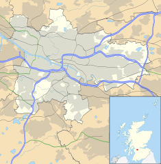
Blank map of Glasgow, UK with the following information shown:
Equirectangular map projection on WGS 84 datum, with N/S stretched 175% Geographic limits:
|
| Date | |
| Bun |
|
| Author | Nilfanion, created using Ordnance Survey data |
| Permission (Reusing this file) |
This file is licensed under the Creative Commons Attribution-Share Alike 3.0 Unported license. Attribution: Contains Ordnance Survey data © Crown copyright and database right
|
| Other versions | File:Glasgow UK blank map.svg - Blank map |
Shennaghys y choadan
Crig er daayt/am ennagh son fakin er y choadan myr v’eh ec y traa shen.
| Daayt/Am | Ingin-ordaag | Towshanyn | Ymmydeyr | Cohaggloo | |
|---|---|---|---|---|---|
| bio | 17:24, 6 Toshiaght Arree 2012 | | 1,357 × 1,384 (1,006 KB) | Jheald | Updated for M80 and M74 (hand-edited in with Inkscape, tracing a screengrab from OpenStreetmap). |
| 20:15, 26 Mean Fouyir 2010 |  | 1,357 × 1,384 (1,002 KB) | Nilfanion | {{Information |Description=Blank map of Glasgow, UK with the following information shown: *Administrative borders *Coastline, lakes and rivers *Roads and railways *Urban areas Equirectangular map projection on WGS 84 datum, with N/S stretch |
Ymmyd y choadan
Ta ny 1 duillag eiyrtyssagh kianglt rish y choadan shoh:
Global file usage
The following other wikis use this file:
- Usage on ar.wikipedia.org
- Usage on azb.wikipedia.org
- Usage on az.wikipedia.org
- Usage on ban.wikipedia.org
- Usage on bg.wikipedia.org
- Usage on ceb.wikipedia.org
- Usage on de.wikipedia.org
- Ibrox Stadium
- Hampden Park
- Celtic Park
- Hamilton Crescent
- Firhill Stadium
- Emirates Arena
- Ibrox Park
- OVO Hydro
- Vorlage:Positionskarte Schottland Glasgow
- Scotstoun Stadium
- Glasgow City Heliport
- Springvale Park
- Cathkin Park (1872)
- Hampden Park (1873)
- Cathkin Park (1884)
- Barrowfield Park
- Hyde Park (Glasgow)
- Braehead Park
- Lesser Hampden
- Usage on en.wikipedia.org
View more global usage of this file.