
Coadan:Lobsterponds.jpg
Cha nel jeeskeaylley ny smoo ry-gheddyn.
Lobsterponds.jpg (640 × 480 phixel, mooadys y choadan: 145 KB, sorçh MIME: image/jpeg)
Giare-choontey
| Coontey |
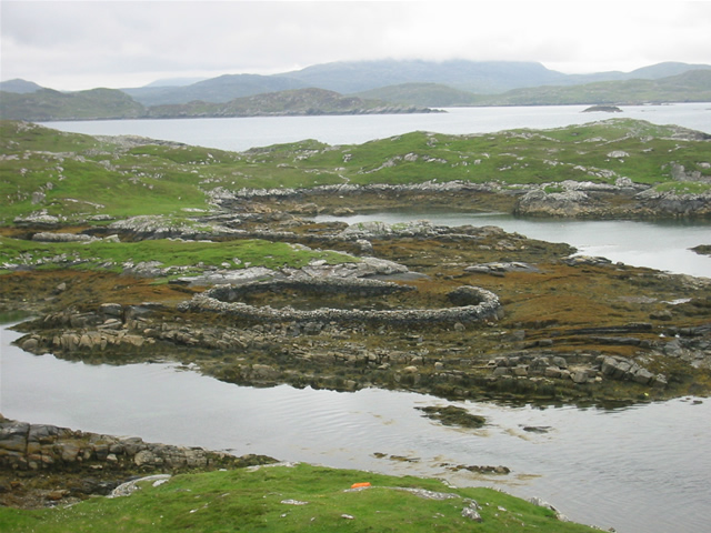
w:Great Bernera, w:Outer Hebrides, Scotland. Lobster ponds Huge stone lobster ponds, as viewed from the footpath from Bhalasaigh to Bostadh. |
||
| Date | See image source page. | ||
| Bun |
This image was taken from the Geograph project collection. See this photograph's page on the Geograph website for the photographer's contact details. The copyright on this image is owned by Graham Orriss and is licensed for reuse under the Creative Commons Attribution-ShareAlike 2.0 license.
This file is licensed under the Creative Commons Attribution-Share Alike 2.0 Generic license. Attribution: Graham Orriss
|
||
| Author | See above. | ||
| Permission (Reusing this file) |
See above. |

| Camera location | | View this and other nearby images on: OpenStreetMap |
|---|
| Object location | | View this and other nearby images on: OpenStreetMap |
|---|
_region:GB-GBN_heading:202.00&language=gv)
Kieddagh:
This file is licensed under the Creative Commons Attribution-Share Alike 2.0 Generic license.
- You are free:
- to share – to copy, distribute and transmit the work
- to remix – to adapt the work
- Under the following conditions:
- attribution – You must give appropriate credit, provide a link to the license, and indicate if changes were made. You may do so in any reasonable manner, but not in any way that suggests the licensor endorses you or your use.
- share alike – If you remix, transform, or build upon the material, you must distribute your contributions under the same or compatible license as the original.
Shennaghys y choadan
Crig er daayt/am ennagh son fakin er y choadan myr v’eh ec y traa shen.
| Daayt/Am | Ingin-ordaag | Towshanyn | Ymmydeyr | Cohaggloo | |
|---|---|---|---|---|---|
| bio | 12:51, 7 Jerrey Souree 2008 | | 640 × 480 (145 KB) | MacRusgail | == Summary == {{Information| |Description=w:Great Bernera, w:Outer Hebrides, Scotland. Lobster ponds Huge stone lobster ponds, as viewed from the footpath from Bhalasaigh to Bostadh. |Source=This image was taken from the Geograph project c |
Ymmyd y choadan
Ta ny 1 duillag eiyrtyssagh kianglt rish y choadan shoh:
Global file usage
The following other wikis use this file:
- Usage on ast.wikipedia.org
- Usage on br.wikipedia.org
- Usage on ca.wikipedia.org
- Usage on ceb.wikipedia.org
- Usage on cy.wikipedia.org
- Usage on da.wikipedia.org
- Usage on de.wikipedia.org
- Usage on de.wikivoyage.org
- Usage on en.wikipedia.org
- Usage on es.wikipedia.org
- Usage on eu.wikipedia.org
- Usage on ga.wikipedia.org
- Usage on gd.wikipedia.org
- Usage on gl.wikipedia.org
- Usage on it.wikipedia.org
- Usage on kw.wikipedia.org
- Usage on nds.wikipedia.org
- Usage on nl.wikipedia.org
- Usage on pl.wikipedia.org
- Usage on simple.wikipedia.org
- Usage on sv.wikipedia.org
- Usage on uk.wikipedia.org
- Usage on www.wikidata.org