
Coadan:LocationBritishIsles.png
Cha nel jeeskeaylley ny smoo ry-gheddyn.
LocationBritishIsles.png (414 × 516 pixelyn, mooadys y choadan: 9 KB, sorçh MIME: image/png)
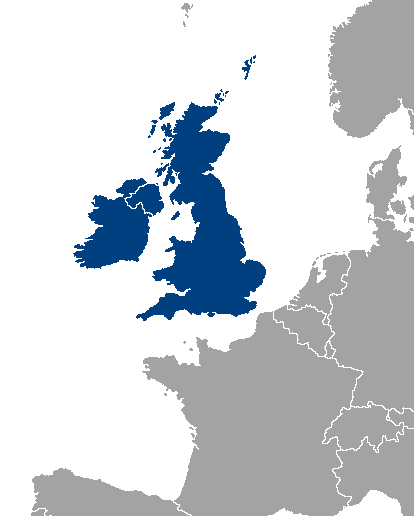
Location map of Great Britain and Ireland.
| |
This work has been released into the public domain by its author, Vardion, at the English Wikipedia project. This applies worldwide. In case this is not legally possible: |
Shennaghys y choadan
Crig er daayt/am ennagh son fakin er y choadan myr v’eh ec y traa shen.
| Daayt/Am | Ingin-ordaag | Towshanyn | Ymmydeyr | Cohaggloo | |
|---|---|---|---|---|---|
| bio | 00:46, 14 Mee Houney 2013 | | 414 × 516 (9 KB) | Fobos92 | . |
| 09:34, 17 Mean Fouyir 2007 |  | 1,245 × 1,245 (52 KB) | Sony-youth | With the CI highlighted. | |
| 10:43, 1 Boaldyn 2007 |  | 1,245 × 1,245 (33 KB) | Tene~commonswiki | Optimised (0) | |
| 02:51, 21 Luanistyn 2006 |  | 1,245 × 1,245 (81 KB) | Hoshie | I have added Montenegro and removed Vojvodina, which is a part of Serbia | |
| 13:12, 10 Jerrey Souree 2006 |  | 1,245 × 1,245 (81 KB) | MPF | new hi-res version | |
| 17:19, 11 Toshiaght Arree 2005 |  | 250 × 115 (3 KB) | Iota~commonswiki | Location map of Great Britain and Ireland. |
Ymmyd y choadan
Ta ny 1 duillag eiyrtyssagh kianglt rish y choadan shoh:
Global file usage
The following other wikis use this file:
- Usage on als.wikipedia.org
- Usage on an.wikipedia.org
- Usage on be-tarask.wikipedia.org
- Usage on be.wikipedia.org
- Usage on bh.wikipedia.org
- Usage on bs.wikipedia.org
- Usage on ca.wikipedia.org
- Usage on ca.wiktionary.org
- Usage on cy.wikipedia.org
- Usage on da.wikipedia.org
- Usage on de.wikipedia.org
- Usage on el.wikipedia.org
- Usage on en.wikipedia.org
- Category:British Isles
- User:Yorkshire Phoenix
- User:Owain/Userbox/British Isles
- User:Meshsa
- Talk:Ireland/Archive 5
- User:Matt Lewis/Nationality within the British Isles (including the United Kingdom and Ireland)
- User:Matt Lewis/Nationality labelling guide for the Republic of Ireland and the United Kingdom of Great Britain and Northern Ireland (including England, Scotland, Wales and the British Islands)
- User:D Dinneen/Userboxes
- Usage on en.wiktionary.org
- Usage on eo.wikipedia.org
- Usage on es.wikipedia.org
- Usage on eu.wikipedia.org
- Usage on frr.wikipedia.org
- Usage on fy.wikipedia.org
- Usage on gl.wikipedia.org
- Usage on hr.wikipedia.org
- Usage on hu.wikipedia.org
- Usage on hy.wikipedia.org
- Usage on id.wikipedia.org
- Usage on incubator.wikimedia.org
- Usage on is.wikipedia.org
- Usage on is.wiktionary.org
- Usage on it.wikipedia.org
- Usage on ka.wikipedia.org
- Usage on kk.wikipedia.org
- Usage on ko.wikipedia.org
- Usage on lb.wikipedia.org
- Usage on lt.wikipedia.org
- Usage on ms.wikipedia.org
- Usage on nl.wikipedia.org
View more global usage of this file.