
Coadan:Lough Foyle View - geograph.org.uk - 1298267.jpg
Cha nel jeeskeaylley ny smoo ry-gheddyn.
Lough_Foyle_View_-_geograph.org.uk_-_1298267.jpg (640 × 426 pixelyn, mooadys y choadan: 45 KB, sorçh MIME: image/jpeg)
Giare-choontey
| Coontey |
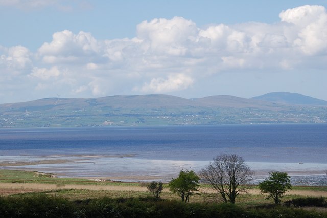
English: Lough Foyle, the view from a picnic site on its southern shore in CarrickHugh (Carraig-Aedha), a small locality in Co. Derry, Northern Ireland |
| Date | |
| Bun | From geograph.org.uk |
| Author | Don MacFarlane |
| Attribution (required by the license) | Don MacFarlane / Lough Foyle View / |
| Object location | | View this and other nearby images on: OpenStreetMap |
|---|
_heading:270.00&language=gv)
Kieddagh:

|
This image was taken from the Geograph project collection. See this photograph's page on the Geograph website for the photographer's contact details. The copyright on this image is owned by Don MacFarlane and is licensed for reuse under the Creative Commons Attribution-ShareAlike 2.0 license.
|
This file is licensed under the Creative Commons Attribution-Share Alike 2.0 Generic license.
Attribution: Don MacFarlane
- You are free:
- to share – to copy, distribute and transmit the work
- to remix – to adapt the work
- Under the following conditions:
- attribution – You must give appropriate credit, provide a link to the license, and indicate if changes were made. You may do so in any reasonable manner, but not in any way that suggests the licensor endorses you or your use.
- share alike – If you remix, transform, or build upon the material, you must distribute your contributions under the same or compatible license as the original.
Shennaghys y choadan
Crig er daayt/am ennagh son fakin er y choadan myr v’eh ec y traa shen.
| Daayt/Am | Ingin-ordaag | Towshanyn | Ymmydeyr | Cohaggloo | |
|---|---|---|---|---|---|
| bio | 10:08, 27 Toshiaght Arree 2011 | | 640 × 426 (45 KB) | GeographBot | == {{int:filedesc}} == {{Information |description={{en|1=Lough Foyle View From CarrickHugh Picnic Site}} |date=2008-03-05 |source=From [http://www.geograph.org.uk/photo/1298267 geograph.org.uk] |author=[http://www.geograph.org.uk/profile/37345 Don MacFarl |
Ymmyd y choadan
Ta ny 1 duillag eiyrtyssagh kianglt rish y choadan shoh:
Global file usage
The following other wikis use this file:
- Usage on af.wikipedia.org
- Usage on ca.wikipedia.org
- Usage on ceb.wikipedia.org
- Usage on de.wikipedia.org
- Usage on en.wikipedia.org
- Usage on eu.wikipedia.org
- Usage on fr.wikipedia.org
- Usage on ga.wikipedia.org
- Usage on he.wikipedia.org
- Usage on nl.wikipedia.org
- Usage on no.wikipedia.org
- Usage on pl.wikipedia.org
- Usage on tr.wikipedia.org
- Usage on www.wikidata.org