
Coadan:Map Cymru gyda rhifau.svg

Size of this PNG preview of this SVG file: 375 × 468 pixels. Other resolutions: 192 × 240 pixels | 385 × 480 pixels | 615 × 768 pixels | 820 × 1,024 pixels | 1,641 × 2,048 pixels.
Jeeskeaylley ymlane (coadan SVG, 375 × 468 pixelyn dy ennymagh, mooadys y choadan: 30 KB)
This version has all the extra SVG-cruft removed, all counties and their numbers in separate groups, and the "id" field of each group set to the Welsh name of each county rather than a number.
Giare-choontey
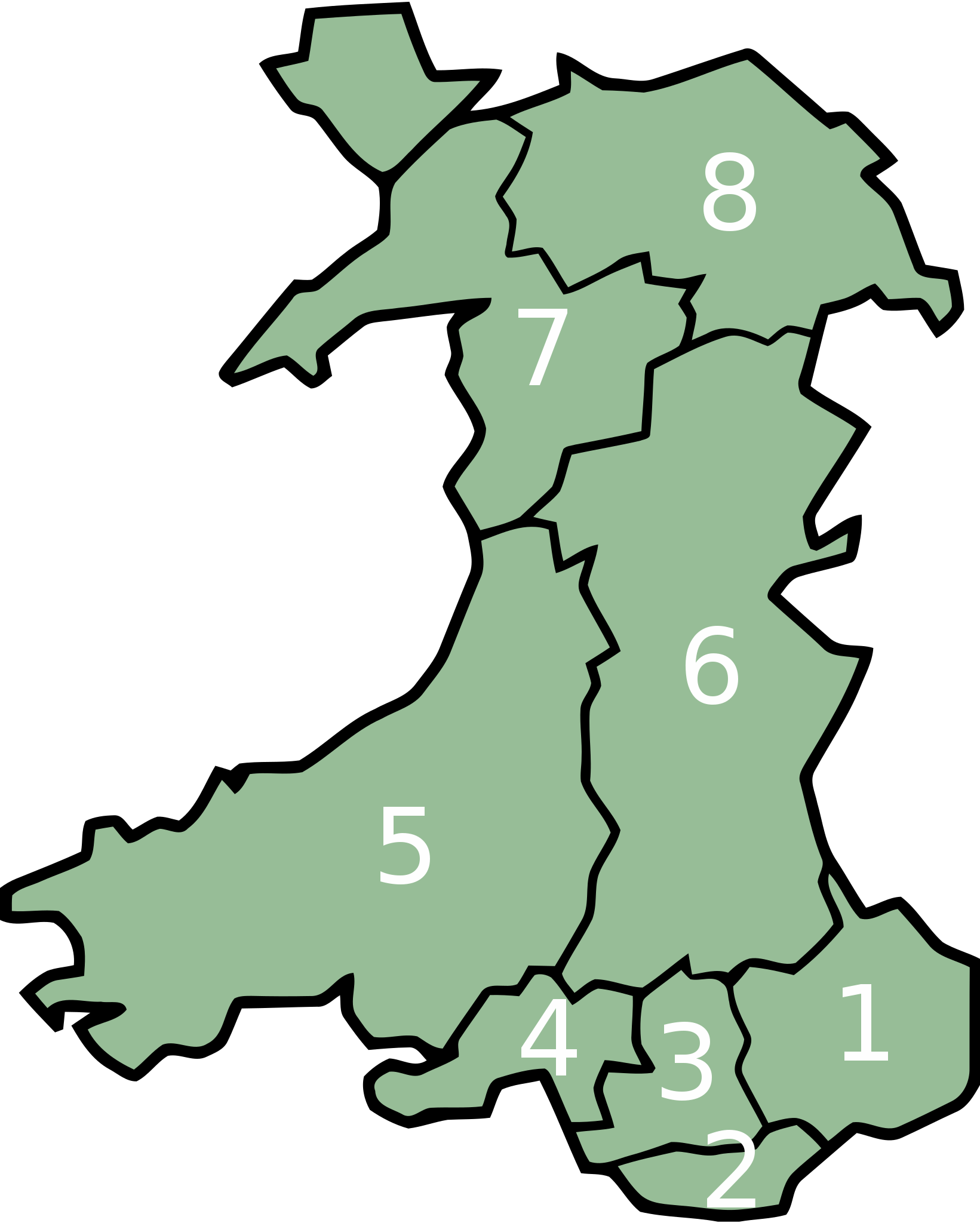
| Coontey | Map of en:Preserved counties of Wales, with effect from April 2, 2003 |
| Date | |
| Bun | Image:WalesNumbered2003.png |
| Author | User:Marnanel, after en:User:Keith Edkins |
| Permission (Reusing this file) |
GFDL |
Kieddagh:
| This file is licensed under the Creative Commons Attribution-Share Alike 3.0 Unported license. Subject to disclaimers. | ||
| ||
| This licensing tag was added to this file as part of the GFDL licensing update. |

|
Permission is granted to copy, distribute and/or modify this document under the terms of the GNU Free Documentation License, Version 1.2 or any later version published by the Free Software Foundation; with no Invariant Sections, no Front-Cover Texts, and no Back-Cover Texts. A copy of the license is included in the section entitled GNU Free Documentation License. Subject to disclaimers. |
Shennaghys y choadan
Crig er daayt/am ennagh son fakin er y choadan myr v’eh ec y traa shen.
| Daayt/Am | Ingin-ordaag | Towshanyn | Ymmydeyr | Cohaggloo | |
|---|---|---|---|---|---|
| bio | 17:05, 11 Toshiaght Arree 2008 | | 375 × 468 (30 KB) | Marnanel | Based on original Image:WalesNumbered2003.png. Numbers removed with GIMPM; converted to SVG with VectorMagic; numbers re-added with Inkscape. This version has all the extra SVG-cruft removed, all counties and their numbers in separate groups, and the |
| 21:12, 10 Toshiaght Arree 2008 |  | 375 × 468 (48 KB) | Marnanel | == Summary == == Beskrivning == {{Information |Description=Map of en:Preserved counties of Wales, with effect from April 2, 2003 |Source=Image:WalesNumbered2003.png |Date=May 2003 |Author=User:Marnanel, after en:User:Keith Edkins |Permis |
Ymmyd y choadan
Ta ny 1 duillag eiyrtyssagh kianglt rish y choadan shoh:
Global file usage
The following other wikis use this file:
- Usage on ca.wikipedia.org
- Usage on cy.wikipedia.org
- Usage on da.wikipedia.org
- Usage on de.wikipedia.org
- Usage on el.wikipedia.org
- Usage on en.wikipedia.org
- Usage on frr.wikipedia.org
- Usage on gl.wikipedia.org
- Usage on hu.wikipedia.org
- Usage on mk.wikipedia.org
- Usage on pl.wikipedia.org
- Usage on simple.wikipedia.org
- Usage on sl.wikipedia.org
- Usage on zh.wikipedia.org