
Coadan:Nord-Pas-de-Calais region location map.svg

Size of this PNG preview of this SVG file: 800 × 543 pixels. Other resolutions: 320 × 217 pixels | 640 × 434 pixels | 1,024 × 695 pixels | 1,280 × 868 pixels | 2,560 × 1,736 pixels | 1,576 × 1,069 pixels.
Jeeskeaylley ymlane (coadan SVG, 1,576 × 1,069 pixelyn dy ennymagh, mooadys y choadan: 515 KB)
Giare-choontey
| Camera location | | View this and other nearby images on: OpenStreetMap |
|---|
| Coontey |
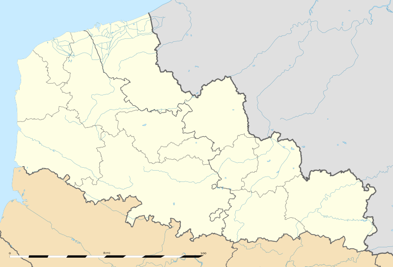
English: Blank administrative map of the region of Nord-Pas-de-Calais, France, as in January 2007, for geo-location purpose, with distinct boundaries for regions, departments and arrondissements.
Français : Carte administrative vierge de la région Nord-Pas-de-Calais, France, telle qu'en janvier 2007, destinée à la géolocalisation, avec limite distincte des régions, départements et arrondissements.
Español: Antigua región de Francia que, con su fusión con la región de Picardía, forma, desde el 1 de enero de 2016, la región de Alta Francia. Estimated scale: 1:520,000 (precision: 130 m)
Geographic limits of the map:
|
||
| Date | |||
| Bun |
Own work |
||
| Author | Eric Gaba (Sting - fr:Sting) | ||
| Permission (Reusing this file) |
|
||
| Other versions |
|

Kieddagh:
Eric Gaba, Wikimedia Commons user Sting, the copyright holder of this work, hereby publishes it under the following license:
This file is licensed under the Creative Commons Attribution-Share Alike 3.0 Unported license.
Attribution: Eric Gaba, Wikimedia Commons user Sting
- You are free:
- to share – to copy, distribute and transmit the work
- to remix – to adapt the work
- Under the following conditions:
- attribution – You must give appropriate credit, provide a link to the license, and indicate if changes were made. You may do so in any reasonable manner, but not in any way that suggests the licensor endorses you or your use.
- share alike – If you remix, transform, or build upon the material, you must distribute your contributions under the same or compatible license as the original.
Shennaghys y choadan
Crig er daayt/am ennagh son fakin er y choadan myr v’eh ec y traa shen.
| Daayt/Am | Ingin-ordaag | Towshanyn | Ymmydeyr | Cohaggloo | |
|---|---|---|---|---|---|
| bio | 22:06, 2 Luanistyn 2011 | | 1,576 × 1,069 (515 KB) | Sting | == {{int:filedesc}} == {{Location|50|31|30|N|02|54|00|E|scale:500000}} {{Information |Description={{en|Blank administrative map of the region of Nord-Pas-de-Calais, France, as in January 2007, for geo-location purpose, with dist |
Ymmyd y choadan
Global file usage
The following other wikis use this file:
- Usage on ar.wikipedia.org
- Usage on be.wikipedia.org
- Usage on bg.wikipedia.org
- Usage on ceb.wikipedia.org
- Usage on de.wikipedia.org
- Usage on el.wikipedia.org
- Usage on en.wikipedia.org
- Usage on eo.wikipedia.org
- Usage on es.wikipedia.org
- Bosque de Arenberg
- Carrefour de l'Arbre
- Mons-en-Pévèle (sector de pavé)
- Sinagoga de Lille
- Plantilla:Mapa de localización de Norte-Paso de Calais
- Basílica de Nuestra Señora de la Inmaculada Concepción de Boulogne-sur-Mer
- Beffroi de Dunkerque
- Basílica catedral de Nuestra Señora y San Vaast (Arrás)
- Tramo de Roubaix
- Usage on fa.wikipedia.org
- Usage on fo.wikipedia.org
- Usage on fr.wikipedia.org
- Université du Littoral-Côte-d'Opale
- Racing Club de Lens
- Catastrophe de Courrières
- Stade Grimonprez-Jooris
- Stade Bollaert-Delelis
- Stade Henri-Jooris
- Stadium Lille Métropole
- Salle du Hainaut
- Quatre Jours de Dunkerque 2006
- Stade Nungesser
- Stades de Flandres
- Liste des commanderies templières dans le Nord-Pas-de-Calais
- Stade Marcel-Tribut
- Championnat de France de football de deuxième division 1937-1938
- Hippodrome de la Canche
- Hippodrome des Hauts-Blancs-Monts
- Stade Pierre-Mauroy
View more global usage of this file.