
Coadan:Relief Map of Latvia.jpg

Size of this preview: 800 × 504 pixels. Other resolutions: 320 × 202 pixels | 640 × 403 pixels | 1,200 × 756 pixels.
Jeeskeaylley ymlane (1,200 × 756 pixelyn, mooadys y choadan: 309 KB, sorçh MIME: image/jpeg)
Giare-choontey
| Coontey |
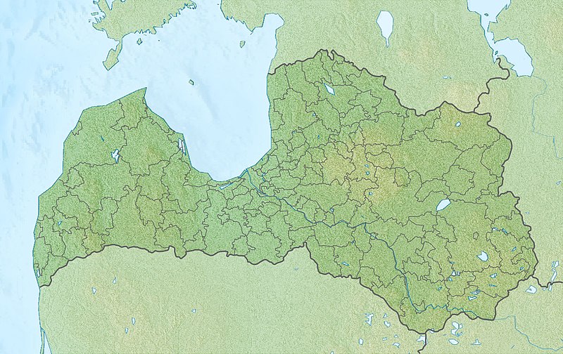
English: Location map of Latvia Equirectangular projection, N/S stretching 170 %. Geographic limits of the map:
|
| Date | (UTC) |
| Bun |
|
| Author |
|
| This is a retouched picture, which means that it has been digitally altered from its original version. The original can be viewed here: Latvia location map.svg:
|
Kieddagh:
I, the copyright holder of this work, hereby publish it under the following licenses:
This file is licensed under the Creative Commons Attribution-Share Alike 3.0 Unported license.
- You are free:
- to share – to copy, distribute and transmit the work
- to remix – to adapt the work
- Under the following conditions:
- attribution – You must give appropriate credit, provide a link to the license, and indicate if changes were made. You may do so in any reasonable manner, but not in any way that suggests the licensor endorses you or your use.
- share alike – If you remix, transform, or build upon the material, you must distribute your contributions under the same or compatible license as the original.

|
Permission is granted to copy, distribute and/or modify this document under the terms of the GNU Free Documentation License, Version 1.2 or any later version published by the Free Software Foundation; with no Invariant Sections, no Front-Cover Texts, and no Back-Cover Texts. A copy of the license is included in the section entitled GNU Free Documentation License. |
You may select the license of your choice.
Original upload log
This image is a derivative work of the following images:
- File:Latvia_location_map.svg licensed with Cc-by-sa-3.0, GFDL
- 2009-07-04T13:16:32Z Gleb Borisov 1305x822 (367838 Bytes) from July 1 the political map of Latvia is like that
- 2009-02-12T10:14:18Z NordNordWest 1305x822 (256639 Bytes) boundaries stay the same until July 2009
- 2008-12-31T17:54:15Z NordNordWest 1305x822 (367838 Bytes)
- 2008-08-29T08:07:14Z NordNordWest 1305x822 (256639 Bytes)
- 2008-07-17T21:18:06Z NordNordWest 652x411 (254520 Bytes) {{Information |Description= {{de|Positionskarte von [[:de:Lettland|Lettland]]}} Quadratische Plattkarte, N-S-Streckung 170 %. Geographische Begrenzung der Karte: * N: 58.5° N * S: 55.5° N * W: 20.5° O * O: 28.6° O {{en|Lo
Uploaded with derivativeFX
Shennaghys y choadan
Crig er daayt/am ennagh son fakin er y choadan myr v’eh ec y traa shen.
| Daayt/Am | Ingin-ordaag | Towshanyn | Ymmydeyr | Cohaggloo | |
|---|---|---|---|---|---|
| bio | 17:32, 27 Mee Houney 2010 | | 1,200 × 756 (309 KB) | Виктор В | {{Information |Description={{en|Location map of Latvia}} Equirectangular projection, N/S stretching 170 %. Geographic limits of the map: * N: 58.5° N * S: 55.5° N * W: 20.5° E * E: 28.6° E |Source=*[[:File:Latvia_location_map.svg|] |
Ymmyd y choadan
Ta ny 1 duillag eiyrtyssagh kianglt rish y choadan shoh:
Global file usage
The following other wikis use this file:
- Usage on an.wikipedia.org
- Usage on ar.wikipedia.org
- Usage on ast.wikipedia.org
- Usage on az.wikipedia.org
- Qauya Milli Parkı
- Şablon:Yer xəritəsi Latviya
- Kemeri Milli Parkı
- Doles yarımadası
- Kolkasraqs burnu
- Teyçi qoruğu
- Venta şəlaləsi
- Slitere Milli Parkı
- Lusavsala
- Latviyanın Milli Botanika Bağı
- Raznas Milli Parkı
- Şimali Vidzeme Biosfer Qoruğu
- Qutman mağarası
- Ventspils Beynəlxalq Radioastronomiya Mərkəzi
- Riqa SES
- Usage on bn.wikipedia.org
- Usage on bs.wikipedia.org
- Usage on ca.wikipedia.org
- Usage on ceb.wikipedia.org
- Usage on ce.wikipedia.org
- Usage on ckb.wikipedia.org
- Usage on cs.wikipedia.org
- Usage on da.wikipedia.org
- Usage on el.wikipedia.org
- Usage on en.wikipedia.org
View more global usage of this file.