
Coadan:Scotland location map.svg

Size of this PNG preview of this SVG file: 456 × 600 pixels. Other resolutions: 182 × 240 pixels | 365 × 480 pixels | 584 × 768 pixels | 779 × 1,024 pixels | 1,558 × 2,048 pixels | 1,128 × 1,483 pixels.
Jeeskeaylley ymlane (coadan SVG, 1,128 × 1,483 pixelyn dy ennymagh, mooadys y choadan: 810 KB)
Giare-choontey
| Coontey |
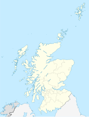
Quadratische Plattkarte, N-S-Streckung 170 %. Geographische Begrenzung der Karte:
Equirectangular projection, N/S stretching 170 %. Geographic limits of the map:
|
||
| Date | 9 Jerrey Fouyir 2008 (upload date) | ||
| Bun |
own work, using
|
||
| Author | NordNordWest | ||
| Other versions |
Derivative works of this file:
|
||
| SVG genesis |
|


Kieddagh:
I, the copyright holder of this work, hereby publish it under the following licenses:

|
Permission is granted to copy, distribute and/or modify this document under the terms of the GNU Free Documentation License, Version 1.2 or any later version published by the Free Software Foundation; with no Invariant Sections, no Front-Cover Texts, and no Back-Cover Texts. A copy of the license is included in the section entitled GNU Free Documentation License. |
This file is licensed under the Creative Commons Attribution-Share Alike 3.0 Unported license.
Attribution: Eric Gaba, NordNordWest
- You are free:
- to share – to copy, distribute and transmit the work
- to remix – to adapt the work
- Under the following conditions:
- attribution – You must give appropriate credit, provide a link to the license, and indicate if changes were made. You may do so in any reasonable manner, but not in any way that suggests the licensor endorses you or your use.
- share alike – If you remix, transform, or build upon the material, you must distribute your contributions under the same or compatible license as the original.
You may select the license of your choice.
Shennaghys y choadan
Crig er daayt/am ennagh son fakin er y choadan myr v’eh ec y traa shen.
| Daayt/Am | Ingin-ordaag | Towshanyn | Ymmydeyr | Cohaggloo | |
|---|---|---|---|---|---|
| bio | 18:27, 9 Jerrey Fouyir 2008 | | 1,128 × 1,483 (810 KB) | NordNordWest | {{Information |Description= {{de|Positionskarte von Schottland, Vereinigtes Königreich}} Quadratische Plattkarte, N-S-Streckung 170 %. Geographische Begrenzung der Karte: * N: 61.0° N * S: 54.5° N * W: |
Ymmyd y choadan
Ta ny 23 duillagyn eiyrtyssagh kianglt rish y choadan shoh:
- Aberdon
- An Gearasdan
- Ard Rushen
- Ard ny Goair
- Ard ny Mwyllin
- Baie yn Chashtal
- Baile a' Mhanaich
- Balley'n Cheeylysh
- Balley Keeill Charane
- Balley ny Gaauin
- Breacleit
- Cill Rìmhinn
- Dalabrog
- Doon Edin
- Eairee ny Goair
- Glaschu
- Grianaig
- Inbhir Nis
- Keeill Choobragh
- Keeill Vreeshey Hiar
- Logh ny Moddee
- Steornavaie
- Yn Ooig
Global file usage
The following other wikis use this file:
- Usage on ab.wikipedia.org
- Usage on af.wikipedia.org
- Gebruiker:Laurens
- Rugbywêreldbeker 2007
- Skerryvore
- Sjabloon:Liggingkaart Skotland
- Aberdeen (dubbelsinnig)
- Auchtermuchty
- Inverness
- Kirkwall
- Gruinard-eiland
- Lockerbie
- Ben Nevis
- Skara Brae
- Govan
- Verenigde Rugbykampioenskap
- Aberfoyle, Stirling
- Alloway
- Skotse nasionale krieketspan
- Dumfries
- Glen Coe
- Bonnybridge
- Ayr
- Luss
- Usage on ar.wikipedia.org
- Usage on arz.wikipedia.org
- Usage on ast.wikipedia.org
- Usage on azb.wikipedia.org
View more global usage of this file.