
Coadan:St Stephens by Launceston, Higher New Bridge - geograph.org.uk - 37541.jpg
Cha nel jeeskeaylley ny smoo ry-gheddyn.
St_Stephens_by_Launceston,_Higher_New_Bridge_-_geograph.org.uk_-_37541.jpg (640 × 430 pixelyn, mooadys y choadan: 93 KB, sorçh MIME: image/jpeg)
Giare-choontey
| Coontey |
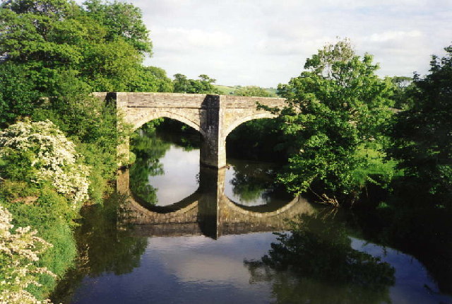
English: Higher New Bridge over the River Tamar, between St Stephens by Launceston in Cornwall, and St Giles on the Heath in Devon |
| Date | |
| Bun | From geograph.org.uk |
| Author | Martin Bodman |
| Attribution (required by the license) | Martin Bodman / St Stephens by Launceston: Higher New Bridge / |
| Camera location | | View this and other nearby images on: OpenStreetMap |
|---|
_heading:135.00&language=gv)
| Object location | | View this and other nearby images on: OpenStreetMap |
|---|
_heading:135.00&language=gv)
Kieddagh:

|
This image was taken from the Geograph project collection. See this photograph's page on the Geograph website for the photographer's contact details. The copyright on this image is owned by Martin Bodman and is licensed for reuse under the Creative Commons Attribution-ShareAlike 2.0 license.
|
This file is licensed under the Creative Commons Attribution-Share Alike 2.0 Generic license.
Attribution: Martin Bodman
- You are free:
- to share – to copy, distribute and transmit the work
- to remix – to adapt the work
- Under the following conditions:
- attribution – You must give appropriate credit, provide a link to the license, and indicate if changes were made. You may do so in any reasonable manner, but not in any way that suggests the licensor endorses you or your use.
- share alike – If you remix, transform, or build upon the material, you must distribute your contributions under the same or compatible license as the original.
Shennaghys y choadan
Crig er daayt/am ennagh son fakin er y choadan myr v’eh ec y traa shen.
| Daayt/Am | Ingin-ordaag | Towshanyn | Ymmydeyr | Cohaggloo | |
|---|---|---|---|---|---|
| bio | 17:24, 30 Jerrey Geuree 2010 | | 640 × 430 (93 KB) | GeographBot | == {{int:filedesc}} == {{Information |description={{en|1=St Stephens by Launceston: Higher New Bridge. An old crossing of the river Tamar into Cornwall, on the Holsworthy road}} |date=1998-05 |source=From [http://www.geograph.org.uk/photo/37541 geograph.o |
Ymmyd y choadan
Ta ny 1 duillag eiyrtyssagh kianglt rish y choadan shoh:
Global file usage
The following other wikis use this file:
- Usage on dag.wikipedia.org
- Usage on en.wikipedia.org
- Usage on es.wikipedia.org
- Usage on fa.wikipedia.org
- Usage on www.wikidata.org