
Coadan:Ulster locator map.svg

Size of this PNG preview of this SVG file: 481 × 599 pixels. Other resolutions: 192 × 240 pixels | 385 × 480 pixels | 616 × 768 pixels | 822 × 1,024 pixels | 1,643 × 2,048 pixels | 1,450 × 1,807 pixels.
Jeeskeaylley ymlane (coadan SVG, 1,450 × 1,807 pixelyn dy ennymagh, mooadys y choadan: 699 KB)
Giare-choontey
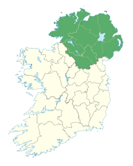
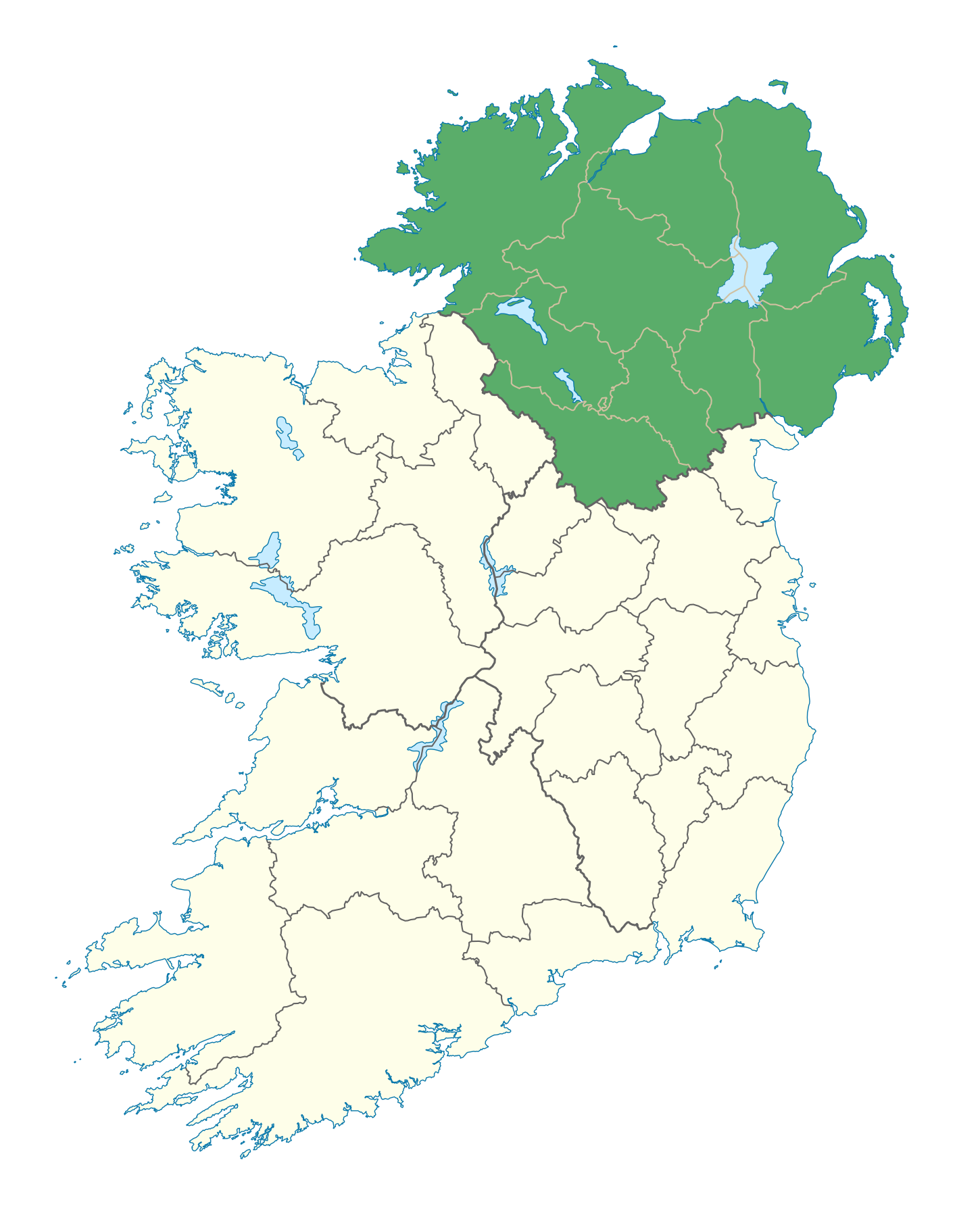
| Coontey | Locator map of Ulster. |
| Date | (UTC) |
| Bun | |
| Author |
|
Kieddagh:
I, the copyright holder of this work, hereby publish it under the following license:
This file is licensed under the Creative Commons Attribution-Share Alike 3.0 Unported license.
- You are free:
- to share – to copy, distribute and transmit the work
- to remix – to adapt the work
- Under the following conditions:
- attribution – You must give appropriate credit, provide a link to the license, and indicate if changes were made. You may do so in any reasonable manner, but not in any way that suggests the licensor endorses you or your use.
- share alike – If you remix, transform, or build upon the material, you must distribute your contributions under the same or compatible license as the original.
Shennaghys y choadan
Crig er daayt/am ennagh son fakin er y choadan myr v’eh ec y traa shen.
| Daayt/Am | Ingin-ordaag | Towshanyn | Ymmydeyr | Cohaggloo | |
|---|---|---|---|---|---|
| bio | 19:49, 7 Jerrey Geuree 2012 | | 1,450 × 1,807 (699 KB) | NikNaks | Fix |
| 18:31, 7 Jerrey Geuree 2012 |  | 1,450 × 1,807 (700 KB) | NikNaks | Remove modern boundaries | |
| 18:27, 7 Jerrey Geuree 2012 |  | 1,450 × 1,807 (720 KB) | NikNaks | Updating with new map | |
| 17:50, 7 Jerrey Geuree 2012 |  | 400 × 500 (281 KB) | NikNaks93 | == {{int:filedesc}} == {{Information |Description=Locator map of Ulster. |Source=*File:Ireland_trad_counties_named.svg |Date=2012-01-07 17:50 (UTC) |Author=*File:Ireland_trad_counties_named.svg: *[[:File:Population_density_of_Ireland_map2002.s |
Ymmyd y choadan
Ta ny 1 duillag eiyrtyssagh kianglt rish y choadan shoh:
Global file usage
The following other wikis use this file:
- Usage on ar.wikipedia.org
- Usage on ast.wikipedia.org
- Usage on az.wikipedia.org
- Usage on bg.wikipedia.org
- Usage on ca.wikipedia.org
- Usage on ceb.wikipedia.org
- Usage on cs.wikipedia.org
- Usage on el.wikipedia.org
- Usage on en.wikipedia.org
- Ulster
- Sperrins
- List of Ireland-related topics
- Mourne Mountains
- Derryveagh Mountains
- Blue Stack Mountains
- Slieve Croob
- Lists of mountains in Ireland
- Fair Head
- Errigal
- Slieve Donard
- Divis
- Slieve League
- Binevenagh
- Slemish
- Glenarm
- Cuilcagh
- Glenariff
- Slieve Bearnagh
- Cavehill
- Ulster Senior Football Championship
- Slieve Binnian
- Glendun
- Slieve Muck
- Slieve Gullion
- Muckish
- Seven Sisters, Donegal
- Crocknalaragagh
- Aghla Beg
- Ardloughnabrackbaddy
- Aghla More
- Mackoght
- Donald's Hill
- Black Mountain (Belfast)
- User:Danny1501
- Template:User Ulster
- Tievebulliagh
- User:Ro2000
- Slieve Beagh
- Slieve Snaght
- Sawel Mountain
- User:Weeman com
View more global usage of this file.