Jump to content

Cronk Meayll

Co-ordnaidyn: 54°04′27″N 4°46′07″W / 54.0740534°N 4.76866°W / 54.0740534; -4.76866
Ass Wikipedia.
Cronk Meayll
Mull Hill (en)

Kiarkyl y Veayll er mullagh Chronk Meayll, jeeaghyn lesh Purt Çhiarn
Cronk Meayll is located in Mannin
Cronk Meayll
Cronk Meayll
Boayl s'yrjey
Yrjid 169 m (554 ft)
Yrjid chonastagh 154 m (505 ft)
Rolley Marilyn
Co-ordnaidyn 54°04′27″N 4°46′07″W / 54.0740534°N 4.76866°W / 54.0740534; -4.76866
Towshanyn
Enmys
Çheer-oaylleeaght
Soiaghey Mannin
Ingagh OS SC189676
Caslys-çheerey boayl-oaylleeagh OS Landranger 95
IOM Outdoor Leisure Map (S)
Creg-oaylleeaght
Drappal
Map

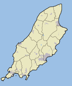
She cronk beg ayns Skeerey Rosien ec jiass Vannin eh Cronk Meayll (Baarle: Meayll Hill ny Mull Hill). T'eh soit faggys da Creneash. She soiaghey carn shamyragh enmyssit Kiarkyl y Veayll t'eh. Faggys da'n vullagh ta tholtanyn stashoon radar Chain Home Low.

She lhiaght shenndaaleeagh er lheh eh Kiarkyl y Veayll. T'eh jeant ass daa hamyr oanluckee yeig ayns kiarkyl marish shey bollee stiagh ta goll stiagh dys piyr dy hamyryn. Ta smooiraneyn dy phasheydys ornaidagh, craueyn lieh-lostit, greieyn clagh aile, as shillee chlagh ghreiney er ny ve feddynit magh ayns ny shamyryn oanluckee. V'eh troggit mygeayrt y vlein 3500 RC.

Kiarkyl y Veayll

[reagh | edit source]

Imraaghyn

[reagh | edit source]
  • Kermode, Philip Moore Callow (June 1894), Allen, J. Romilly (rd.), "The illustrated archaeologist: a quarterly journal, devoted to the study of the antiquities of Great Britain; the development of the arts and industries of man in past ages; and the survivals of ancient usages and appliances in the present", The Illustrated Archaeologist, Lunnin: Charles J. Clark (er ny hoilshey er 1894), I: 1–8
  • Kermode, Philip Moore Callow; Herdman, W. A. (1904), Illustrated Notes on Manks Antiquities, Lerphoyll

Kianglaghyn magh

[reagh | edit source]