
Coadan:Antarctica Map.png

Size of this preview: 488 × 600 pixels. Other resolutions: 195 × 240 pixels | 502 × 617 pixels.
Jeeskeaylley ymlane (502 × 617 pixelyn, mooadys y choadan: 52 KB, sorçh MIME: image/png)
- Deutsch: Karte der Antarktis
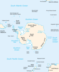
- English: Map of Antarctica
- Español: Mapa de la Antártida
- Polski: Mapa Antarktydy
- For a French version, see : Image:Antarctique_carte.png
- For an German version, see : Image:Antarctica_Karte.png
This image is in the public domain because it contains materials that originally came from the United States Central Intelligence Agency's World Factbook.
|
 |
derivative works
Derivative works of this file: Map-antarctica-ross-ice-shelf-red-x.png
Shennaghys y choadan
Crig er daayt/am ennagh son fakin er y choadan myr v’eh ec y traa shen.
| Daayt/Am | Ingin-ordaag | Towshanyn | Ymmydeyr | Cohaggloo | |
|---|---|---|---|---|---|
| bio | 23:16, 15 Mee ny Nollick 2004 | | 502 × 617 (52 KB) | Mschlindwein |
Ymmyd y choadan
Cha nel duillag erbee kianglt rish y choadan shoh.
Global file usage
The following other wikis use this file:
- Usage on an.wikipedia.org
- Usage on ar.wikipedia.org
- Usage on avk.wikipedia.org
- Usage on azb.wikipedia.org
- Usage on be.wikipedia.org
- Usage on bjn.wikipedia.org
- Usage on blk.wikipedia.org
- Usage on bn.wikipedia.org
- Usage on br.wikipedia.org
- Usage on bs.wikipedia.org
- Usage on ca.wikipedia.org
- Usage on cs.wikipedia.org
- Usage on da.wikipedia.org
- Usage on de.wikinews.org
- Usage on en.wikipedia.org
- Filchner–Ronne Ice Shelf
- Palmer Land
- Frost Glacier
- Second German Antarctic Expedition
- Totten Glacier
- Wikipedia:WikiProject Antarctica
- Polynesian navigation
- Underwood Glacier
- Farthest South
- Adams Glacier (Wilkes Land)
- Ocean fisheries
- 80th parallel south
- Southern Ocean
- Dibble Iceberg Tongue
- Gilchrist Glacier
- Peterson Glacier
- Bell Glacier
- Blair Glacier
- Blodgett Iceberg Tongue
- Bond Glacier
- Bibliography of Antarctica
- Conger Glacier
- Waldron Glacier
- Whittle Glacier
View more global usage of this file.