
Coadan:Indochina map 1886.jpg

Jeeskeaylley ymlane (1,626 × 2,114 pixelyn, mooadys y choadan: 533 KB, sorçh MIME: image/jpeg)
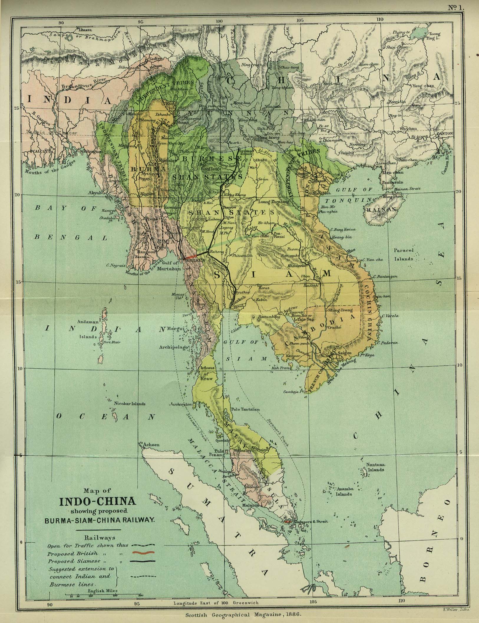
| Coontey | Map of Indochina | ||||
| Date | |||||
| Bun | http://www.lib.utexas.edu/maps/cambodia.html (http://www.lib.utexas.edu/maps/historical/indo_china_1886.jpg); Scottish Geographical Magazine (Volume II) | ||||
| Author | Scottish Geographical Magazine and edited by Hugh A. Webster and Arthur Silva White | ||||
| Permission (Reusing this file) |
|
||||
| Other versions | File:IndoChina1886.jpg | ||||
Shennaghys y choadan
Crig er daayt/am ennagh son fakin er y choadan myr v’eh ec y traa shen.
| Daayt/Am | Ingin-ordaag | Towshanyn | Ymmydeyr | Cohaggloo | |
|---|---|---|---|---|---|
| bio | 02:56, 2 Boaldyn 2008 | | 1,626 × 2,114 (533 KB) | Calliopejen1 | {{Information |Description=Map of French Indochina |Source=http://www.lib.utexas.edu/maps/cambodia.html (http://www.lib.utexas.edu/maps/historical/indo_china_1886.jpg) |Date=1886 |Author=Scottish Geographical Magazine |Permission={{PD-old}} |other_version |
Ymmyd y choadan
Cha nel duillag erbee kianglt rish y choadan shoh.
Global file usage
The following other wikis use this file:
- Usage on bcl.wikipedia.org
- Usage on el.wikipedia.org
- Usage on en.wikipedia.org
- Usage on en.wikiversity.org
- Usage on fi.wikipedia.org
- Usage on got.wikipedia.org
- Usage on kn.wikipedia.org
- Usage on ms.wikipedia.org
- Usage on pa.wikipedia.org
- Usage on sl.wikipedia.org
- Usage on uz.wikipedia.org