
Coadan:Relief Map of Montenegro.svg

Size of this PNG preview of this SVG file: 479 × 583 pixels. Other resolutions: 197 × 240 pixels | 394 × 480 pixels | 631 × 768 pixels | 841 × 1,024 pixels | 1,683 × 2,048 pixels.
Jeeskeaylley ymlane (coadan SVG, 479 × 583 pixelyn dy ennymagh, mooadys y choadan: 3.42 MB)
Giare-choontey
| Coontey |
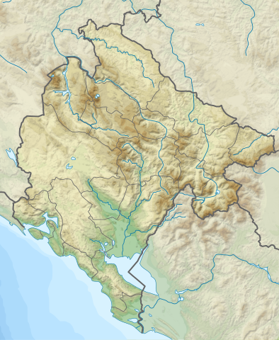
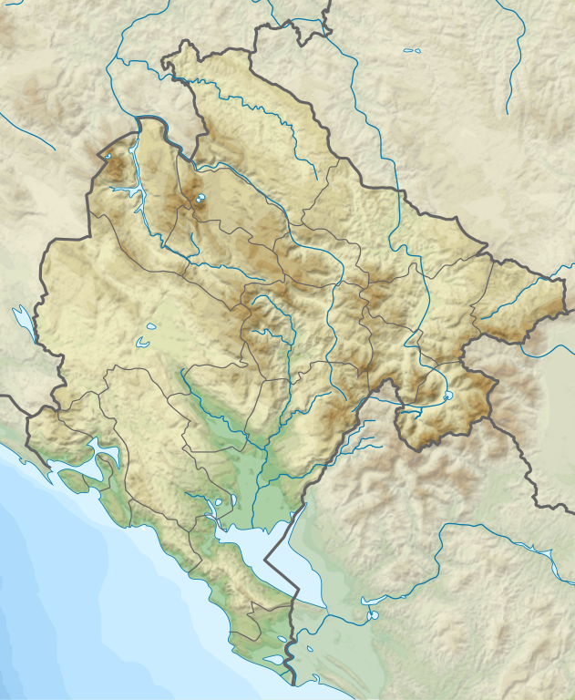
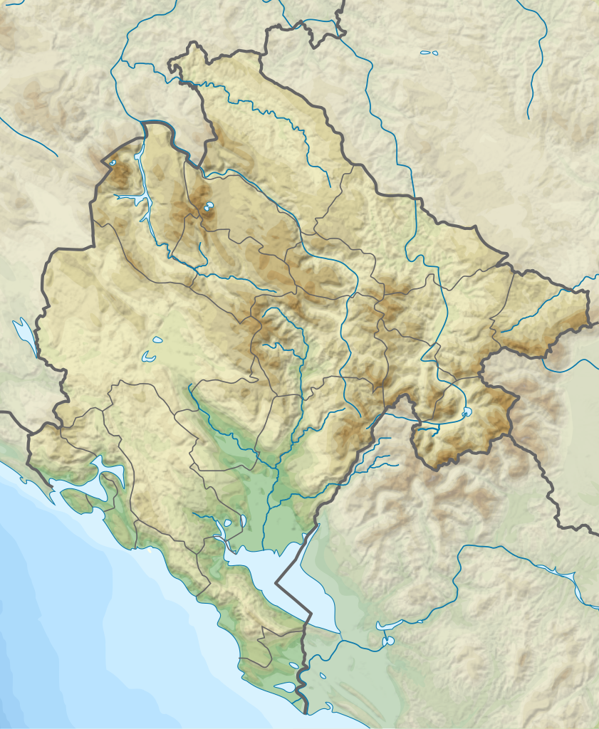
English: Relief Map of Montenegro
Српски / srpski: Топографска мапа Црне Горе |
| Date | |
| Bun | http://sr.wikipedia.org/wiki/%D0%94%D0%B0%D1%82%D0%BE%D1%82%D0%B5%D0%BA%D0%B0:Dinaric_Alps_map_sr.svg |
| Author |
|
Kieddagh:
This file is licensed under the Creative Commons Attribution-Share Alike 3.0 Unported license.
- You are free:
- to share – to copy, distribute and transmit the work
- to remix – to adapt the work
- Under the following conditions:
- attribution – You must give appropriate credit, provide a link to the license, and indicate if changes were made. You may do so in any reasonable manner, but not in any way that suggests the licensor endorses you or your use.
- share alike – If you remix, transform, or build upon the material, you must distribute your contributions under the same or compatible license as the original.
Shennaghys y choadan
Crig er daayt/am ennagh son fakin er y choadan myr v’eh ec y traa shen.
| Daayt/Am | Ingin-ordaag | Towshanyn | Ymmydeyr | Cohaggloo | |
|---|---|---|---|---|---|
| bio | 00:38, 25 Jerrey Souree 2020 | | 479 × 583 (3.42 MB) | Santasa99 | + the river Ćehotina. |
| 17:35, 24 Jerrey Souree 2020 |  | 479 × 583 (3.41 MB) | Santasa99 | Improved with addition of the missing features: rivers, lakes, and borders. | |
| 11:34, 18 Mayrnt 2012 |  | 479 × 583 (3.33 MB) | Ivan25 | borders. | |
| 13:15, 17 Mayrnt 2012 |  | 479 × 583 (3.29 MB) | Ivan25 |
Ymmyd y choadan
Ta ny 1 duillag eiyrtyssagh kianglt rish y choadan shoh:
Global file usage
The following other wikis use this file:
- Usage on ar.wikipedia.org
- Usage on ast.wikipedia.org
- Usage on az.wikipedia.org
- Usage on be.wikipedia.org
- Usage on bn.wikipedia.org
- Usage on bs.wikipedia.org
- Usage on ca.wikipedia.org
- Usage on ceb.wikipedia.org
- Usage on ce.wikipedia.org
- Usage on da.wikipedia.org
- Usage on de.wikipedia.org
- Usage on de.wikivoyage.org
- Usage on el.wikipedia.org
- Usage on en.wikipedia.org
View more global usage of this file.