
Coadan:Rubbles of the cathedral after the earthquake that hit the Capital Port au Prince just before 5 pm on 12 January 2010.jpg
Size of this preview: 800 × 533 pixels. Other resolutions: 320 × 213 pixels | 640 × 427 pixels | 1,024 × 683 pixels | 1,280 × 853 pixels | 3,000 × 2,000 pixels.
Jeeskeaylley ymlane (3,000 × 2,000 phixel, mooadys y choadan: 2.35 MB, sorçh MIME: image/jpeg)
Giare-choontey
| Coontey |
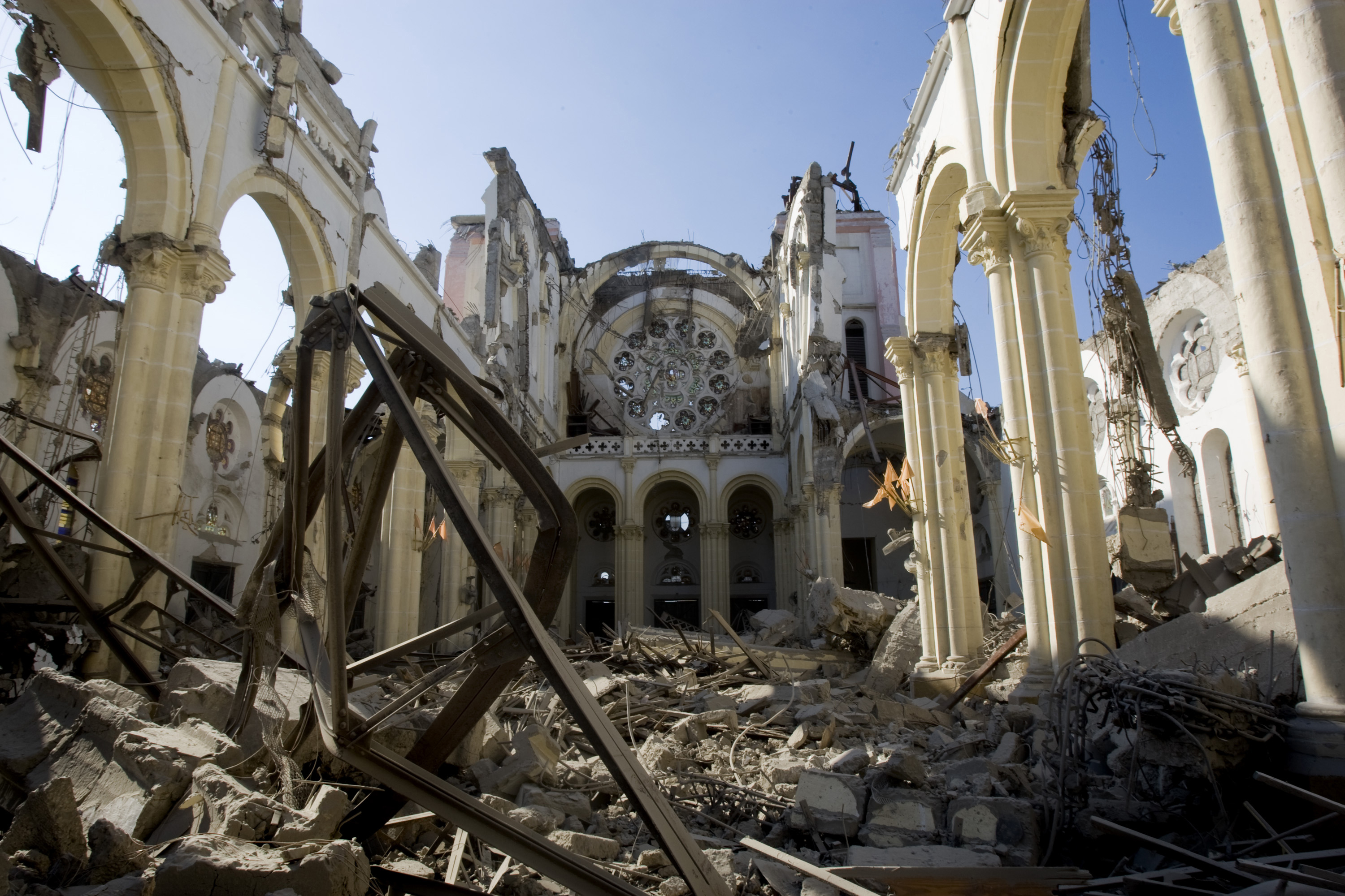
English: Rubbles of the cathedral after the earthquake that hit the Capital Port au Prince just before 5 pm on 12 January 2010
Română: Ruinele catedralei după cutremurul care a zguduit capitala Port au Prince în jurul orei 17 la 12 ianuarie 2010 |
||
| Date | |||
| Bun |
|
||
| Author | Marco Dormino | ||
| Permission (Reusing this file) |
| Object location | | View this and other nearby images on: OpenStreetMap |
|---|
Kieddagh:
This file is licensed under the Creative Commons Attribution-ShareAlike 3.0 IGO license.
- You are free:
- to share – to copy, distribute and transmit the work
- to remix – to adapt the work
- Under the following conditions:
- attribution – You must give appropriate credit, provide a link to the license, and indicate if changes were made. You may do so in any reasonable manner, but not in any way that suggests the licensor endorses you or your use.
- share alike – If you remix, transform, or build upon the material, you must distribute your contributions under the same or compatible license as the original.
Shennaghys y choadan
Crig er daayt/am ennagh son fakin er y choadan myr v’eh ec y traa shen.
| Daayt/Am | Ingin-ordaag | Towshanyn | Ymmydeyr | Cohaggloo | |
|---|---|---|---|---|---|
| bio | 20:38, 22 Mee ny Nollick 2014 | | 3,000 × 2,000 (2.35 MB) | John Cummings | higher res |
| 21:15, 19 Mee ny Nollick 2014 |  | 369 × 246 (68 KB) | John Cummings | User created page with UploadWizard |
Ymmyd y choadan
Ta yn 2 duillag eiyrtyssagh kianglt rish y choadan shoh:
Global file usage
The following other wikis use this file:
- Usage on be.wikimedia.org
- Usage on ca.wikipedia.org
- Usage on ca.wikimedia.org
- Usage on cy.wikipedia.org
- Usage on da.wikipedia.org
- Usage on de.wikipedia.org
- Usage on de.wikivoyage.org
- Usage on en.wikipedia.org
- Wikipedia talk:WikiProject Echo
- Cathedral of Our Lady of the Assumption, Port-au-Prince
- Catholic Church in Haiti
- List of Catholic dioceses in Haiti
- Christianity in Haiti
- Wikipedia talk:WikiProject United Nations/Archive 4
- 2010 Haiti earthquake
- Damage to infrastructure in the 2010 Haiti earthquake
- Wikipedia talk:WikiProject International relations/Archive 5
- Wikipedia talk:WikiProject Education/Archive 8
- Wikipedia:Village pump (miscellaneous)/Archive 48
- Wikipedia talk:WikiProject Medicine/Archive 59
- Wikipedia talk:WikiProject World Heritage Sites/Archive 2
- User:John Cummings/Archive/gallery bug
- Usage on en.wikibooks.org
- Usage on es.wikipedia.org
- Usage on es.wikivoyage.org
- Usage on fa.wikipedia.org
- Usage on fa.wikivoyage.org
- Usage on fr.wikipedia.org
- Usage on fr.wikivoyage.org
- Usage on id.wikipedia.org
- Usage on it.wikipedia.org
- Usage on it.wikivoyage.org
- Usage on ja.wikipedia.org
- Usage on ko.wikipedia.org
- Usage on nl.wikimedia.org
- Usage on nl.wikivoyage.org
- Usage on pl.wikivoyage.org
- Usage on pt.wikipedia.org
- Usage on pt.wikivoyage.org
- Usage on ru.wikipedia.org
- Usage on ru.wikivoyage.org
- Usage on simple.wikipedia.org
- Usage on vi.wikipedia.org
View more global usage of this file.