Manchuin
Appearance
(Aa-enmyssit ass Manchester)
| Manchuin Manchester |
|||
|---|---|---|---|
| — Balley corpagh moirvaljagh as Caayr — | |||
 |
|||
|
|||
 |
|||
| Co-ordnaidyn: 53°28′00″N 02°14′00″W / 53.46667°N 2.23333°W | |||
| Çheer | |||
| Çheer cho-ayrnagh | |||
| Ard | Sostyn Heear Hwoaie | ||
| Coontae jesh-chliaghtagh | Manchuin Vooar | ||
| Bunneeaght | |||
| - 1d eash | Bunnit | ||
| - 1301 | Kaart baljagh | ||
| - 1853 | Staydys caayragh | ||
| Ard-oik reiragh | Çheshvean Chaayr Vanchuin | ||
| Reiltys | |||
| - Sorçh | Balley corpagh moirvaljagh, Caayr | ||
| - Colught | Coonseil Chaayr Vanchuin | ||
| - Çhiarn-veoir | Mark Hackett | ||
| - MPyn | 5 |
||
| Eaghtyr | |||
| - Balley corpagh moirvaljagh | 115.65 km² (44.7 mi ker) | ||
| Yrjid | 38 m (125 tr) | ||
| Earroo yn phobble (2008)[1] | |||
| - Balley corpagh moirvaljagh | 464,200 | ||
| - Glooaght y phobble | 3,815/km² (9,880.8/mi ker) | ||
| - Baljagh | 2,240,230 | ||
| - Moirvaljagh | 2,547,700 | ||
| Cryss hraa | GMT (UTC+0) | ||
| - Sourey (TTSL) | BST (UTC+1) | ||
| Coad postagh | M1-M4, M8-M16, M18-M23, M40, M60, M90 | ||
| Coad(yn) çhellvane | 0161 | ||
| ISO 3166-2 | GB-MAN | ||
| Coad ONS | 00BN | ||
| NUTS 3 | UKD31 | ||
| Ynnyd-eggey | www.manchester.gov.uk | ||
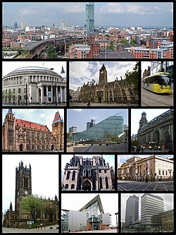
Ta Manchuin (Baarle: Manchester) ny caayr as ny baljaght chorpagh ayns Lancashire, Sostyn. Hooar y balley e stayd caayragh ayns 1853. Va 452,000 deiney cummal 'sy chaayr 'sy vlein 2006, as t'ee soit ayns çheshvean Ard Baljagh Vanchuin Vooar.
Imraaghyn
[reagh | edit source]- ↑ Population estimates for UK, England and Wales, Scotland and Northern Ireland, Mid-2008. National Statistics Online. Office for National Statistics.
Kianglaghyn magh
[reagh | edit source]Ta tooilley mean ayns Wikimedia Commons bentyn rish: Manchester.

