Ymmydeyr:Shimmin Beg/kishtey geinnee
Appearance
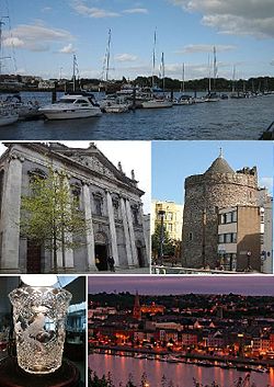
| Purt Largey Port Láirge Waterford |
|||
|---|---|---|---|
 |
|||
|
|||
| Jarroo-raa: Urbs Intacta Manet Waterfordia (Ladjyn) "Ta Purt Largey ny caayr slane foast." |
|||
| Co-ordnaidyn: 52°15′24″N 7°7′45″W / 52.25667°N 7.12917°W | |||
| Çheer | |||
| Queiggey | Mooan | ||
| Coontae | Purt Largey | ||
| Bunneeaght | |||
| - 914 BNJ | Bunneydaght | ||
| Reiltys | |||
| - Sorçh | Coonceil Chaayragh | ||
| - Meoir | Mary Roche | ||
| - Dáil Éireann | Purt Largey | ||
| - Parlamaid ny h-Oarpey | Jiass | ||
| Eaghtyr[1] | |||
| - Caayr | 41.58 km² (16.1 mi ker) | ||
| Earroo yn phobble (2006)[2] | |||
| - Caayr | 45,748 | ||
| - Baljagh | 49,213 | ||
| - Çheerey | 3,465 | ||
| Cryss hraa | GMT (UTC0) | ||
| Coad(yn) çhellvane | 051 | ||
| Earroo-chlaare | W | ||
| Ingagh ogheragh Nerin | S604123 | ||
| Ynnyd-eggey | www.waterfordcity.ie | ||
| Leeds | |||
|---|---|---|---|
| — Caayr as Co-chorp Moirvaljagh — | |||
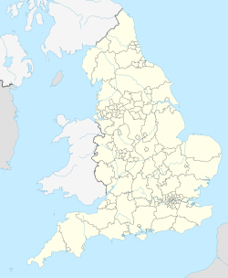
| City of Leeds | |||
 |
|||
|
|||
| Far-enmyn: "Capital of the North",[3][4][5] "Knightsbridge of the North"[6] | |||
| Jarroo-raa: "Pro rege et lege" "Er son ree as leigh" | |||
| Co-ordnaidyn: 53°47′59″N 1°32′57″W / 53.79972°N 1.54917°W | |||
| Çheer | |||
| Çheer cho-ayrnagh | Sostyn | ||
| Ard | Yorkshire as y Humber | ||
| Coontae jesh-chliaghtagh | Yorkshire Heear | ||
| Ard-oik reiragh | Mean Leeds | ||
| Bunneeaght | |||
| - 1207 | Kaart Co-chorp | ||
| - 1626 | Kaart Balley | ||
| - 1893 | Stayd Caayr | ||
| - 1974 | Bunneeaght Slyst Voirvaljagh Caayr Leeds | ||
| Reiltys | |||
| - Sorçh | Co-chorp moirvaljagh, Caayr | ||
| - Coonceil | Coonceil Chaayragh Leeds | ||
| - Çhiarn-Veoir | James McKenna | ||
| - Stiureyder ny Coonceil | Keith Wakefield | ||
| - Ard-sheckter | Paul Rogerson | ||
| Eaghtyr | |||
| - Yn clane | 551.72 km² (213 mi ker) | ||
| Boayl s'yrjey[7] | 340 m (1,115 tr) | ||
| Boayl s'inshley[8] | 10 m (33 tr) | ||
| Earroo yn phobble (tuarym 2008) | |||
| - Yn clane | 770,800 ([[List of English districts by population|Ranked Clowan:EnglishDistrictRank]]) | ||
| - Glooaght y phobble | 1,380/km² (3,574/mi ker) | ||
| - Ethnicity (2001 census)[9] |
89.1% White 5.4% Asian or Asian British 2.0% Black or Black British 1.7% Mixed Race 1.8% Chinese and other |
||
| Ennym ny cummaltee | Loiner/Leodensian | ||
| Cryss hraa | Greenwich Mean Time (UTC+0) | ||
| Postcode | LS,part of WF and also part of BD. | ||
| Coad(yn) çhellvane | 0113 (urban core) 01924 (Wakefield nos) 01937 (Wetherby/ Boston Spa) 01943 (Guiseley/ Otley) 01977 (Pontefract nos) |
||
| ISO 3166-2 | GB-LDS | ||
| ONS code | 00DA | ||
| NUTS 3 | UKE42 | ||
| OS grid reference | Clowan:Gbmappingsmall | ||
| Euro. Parlt. Const. | Yorkshire & the Humber | ||
| Ynnyd-eggey | www.leeds.gov.uk | ||
- ↑ Table 6 Population and area of each Province, County, City, urban area, rural area and Electoral Division, 2002 and 2006 (PDF). Census 2006, Volume 1 - Population Classified by Area d. 99. Oik Staydraa Nerin. Feddynit er 2010-07-24.
- ↑ Table 7 Persons in each town of 1,500 population and over, distinguishing those within legally defined boundaries and in suburbs or environs, 2002 and 2006 (PDF) (Baarle). Census 2006, Volume 1 - Population Classified by Area d. 119. Oik Staydraa Nerin. Feddynit er 2010-07-24.
- ↑ http://www.streetdirectory.com/travel_guide/209092/europe_destinations/leeds_is_the_north_unofficial_capital_city.html
- ↑ http://www.bbc.co.uk/leeds/content/articles/2005/02/08/living_stars_leeds_chart_capital_feature.shtml
- ↑ http://www.yorkshire-forward.com/our-wonderful-region/our-cities/Leeds-the-facts
- ↑ http://www.trueknowledge.com/q/leeds_nicknames
- ↑ Max at SE140445 Hawksworth Moor in extreme west of city
- ↑ Min at points where city boundary crosses Rivers Aire and Wharfe in extreme east.
- ↑ National Statistics: Neighbourhood Statistics. "Leeds (Local Authority): Key Figures for People and Society: Population and Migration". Feddynit magh er 2008-03-25.
- ↑ Clowan:Cite document
- ↑ Cite error: Invalid
<ref>tag; no text was provided for refs namedurban_area_pop - ↑ Cite error: Invalid
<ref>tag; no text was provided for refs namedmetro_area_1 - ↑ Cite error: Invalid
<ref>tag; no text was provided for refs namedmetro_area_2 - ↑ Cite error: Invalid
<ref>tag; no text was provided for refs named2007 ethnicity


